The Daily Standard
Pictures Archive

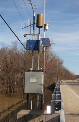
The U.S. Geological Survey installed a solar-powered water monitoring system over the St. Marys River a few years ago on the state Route 118 bridge northeast of Rockford. Its purpose is to show river level changes over time. At 6:30 a.m. today, the river was at 8.78 feet, well below flood stage of 13 feet.