The Daily Standard
World News

This July 14, 2021 photo provided by Lawrence Berkeley National Laboratory shows a rain gauge that will measure the amount of liquid precipitation that falls during the Atmospheric Radiation Measurement (ARM) user facility's Surface Atmosphere Integrated Field Laboratory (SAIL) field campaign in Gothic, Colo. Measurements from the rain gauge will also help scientists validate precipitation estimates from radar. (John Bilberry/Lawrence Berkeley National Laboratory via AP)
FLAGSTAFF, Ariz. (AP) - The U.S. Department of Energy on Tuesday announced a new kind of climate observatory near the headwaters of the Colorado River that will help scientists better predict rain and snowfall in the U.S. West and determine how much of it will flow through the region.
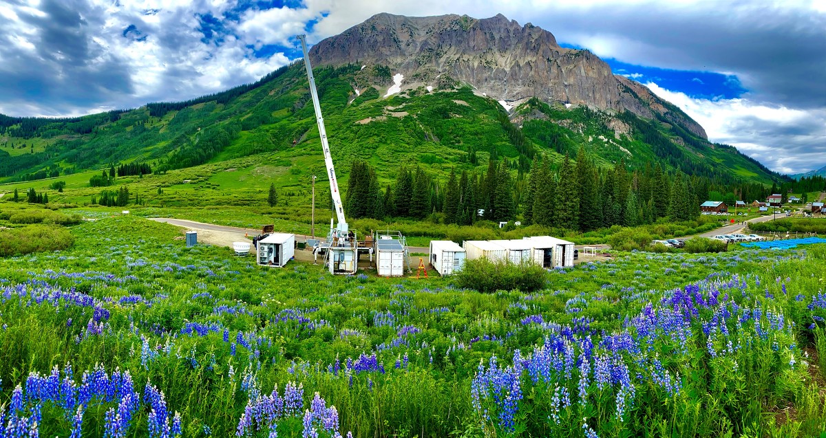
The multimillion-dollar effort led by Lawrence Berkeley National Laboratory launches next week. The team has set up radar systems, balloons, cameras and other equipment in an area of Colorado where much of the water in the river originates as snow. More than 40 million people depend on the Colorado River.
Alejandro Flores, an associate professor of hydrology at Boise State University, said the weather in mountainous areas is notoriously difficult to model and the observatory will be a "game changer."
"We have to think about the land and the atmosphere as a linked system that interact with each other," he said in a call with reporters. "Up until now, there have been a lack of observations that help us understand this critical interface."
The West is in the midst of a more than 20-year megadrought that studies link to human-caused climate change. That, along with increased demand on the Colorado River led to the first-ever shortage declaration in August, and there's an increasing threat of deeper, more widespread water cuts. Arizona, Nevada and Mexico won't get their full allocations of river water next year.
In this June 2021 photograph, provided by the Lawrence Berkeley National Laboratory, construction of the second Atmospheric Radiation Measurement mobile facility (AMF2) is finished for the day in Gothic, Colo. Federal scientists are launching an effort to better understand the hydrology in the U.S. West. The U.S. Department of Energy on Tuesday, Aug. 24 announced a new kind of climate observatory near the headwaters of the Colorado River. (Ken Williams/Lawrence Berkeley National Laboratory via AP)
Scientists will use the observatory to gather data on precipitation, wind, clouds, tiny particles, humidity, soil moisture and other things. Along with a better understanding of the hydrology, they hope to learn more about how wildfires, forest management, drought and tree-killing bugs, for example, play a part in water availability.
A big issue in predicting water supply in the West centers on soil moisture and content, said Ken Williams, the lead on-site researcher and Berkeley Lab scientist. The monsoon season largely was a dud across the Southwest for the past two years, which means more melting snow soaks into the ground before reaching streams and rivers when it does rain, he said.
Climate experts said during a separate briefing Tuesday that southern Arizona and parts of New Mexico have seen impressive rainfall totals so far this monsoon season, with Tucson marking its wettest July on record. Mike Crimmins, a professor at the University of Arizona, called it an "amazing reversal" for the desert city.
Some parts of the Southwest have seen as much as four times their normal precipitation levels. But Crimmins noted other spots like Albuquerque, New Mexico, are either at average levels or still lagging.
"We have both really wet conditions for the short term, but we also have longer-term drought still hanging out there because we have these longer-term deficits that we cannot solve with just one or two or even three months of precipitation," he said.
To reverse the longer-term trends, the region would need to see back-to-back wet winters and summers that are hard to come by, Crimmins said.
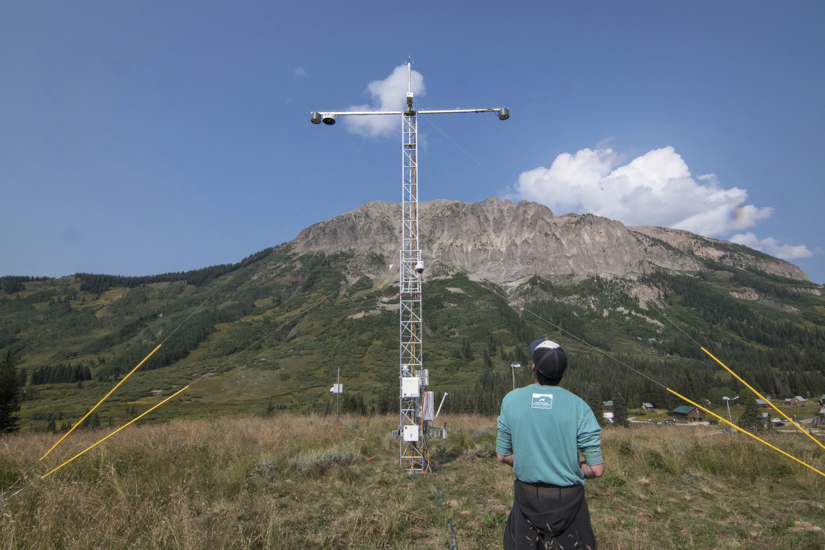
In this Aug. 16, 2021 photo provided Lawrence Berkeley National Laboratory, John Bilberry looks up at an Atmospheric Radiation Measurement instrument tower installed for the Surface Atmosphere Integrated Field Laboratory (SAIL) field campaign in Gothic, Colo. The SAIL campaign will provide insights into mountainous water-cycle processes. Federal scientists are launching an effort to better understand the hydrology in the U.S. West. The U.S. Department of Energy on Tuesday, Aug. 24 announced a new kind of climate observatory near the headwaters of the Colorado River. (David Chu/Lawrence Berkeley National Laboratory via AP)
The new climate observatory, called the Surface Atmosphere Integrated Field Laboratory, brings together federal scientists, university researchers and others to build on a previous effort to study part of the upper Gunnison River basin in Colorado that shares characteristics with the Rocky Mountains.
For the Rio Grande basin, the data could help water managers as they juggle longstanding water sharing agreements among Colorado, New Mexico, Texas and Mexico, Williams said. It also could help improve weather forecasting and experiments to modify the weather, such as cloud seeding to produce more precipitation.
The data will be available to other researchers and provide a benchmark for any collection beyond the two-year project, scientists said.
___
Associated Press writer Susan Montoya Bryan in Albuquerque, New Mexico, contributed to this report.
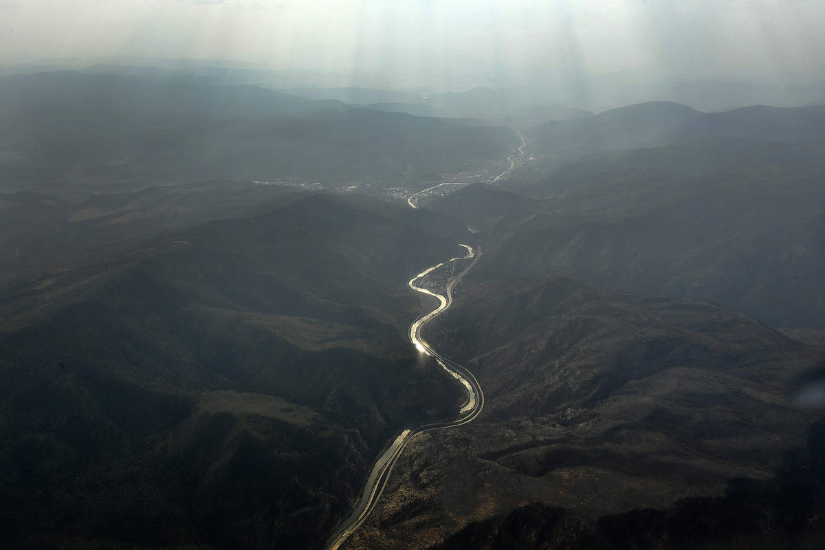
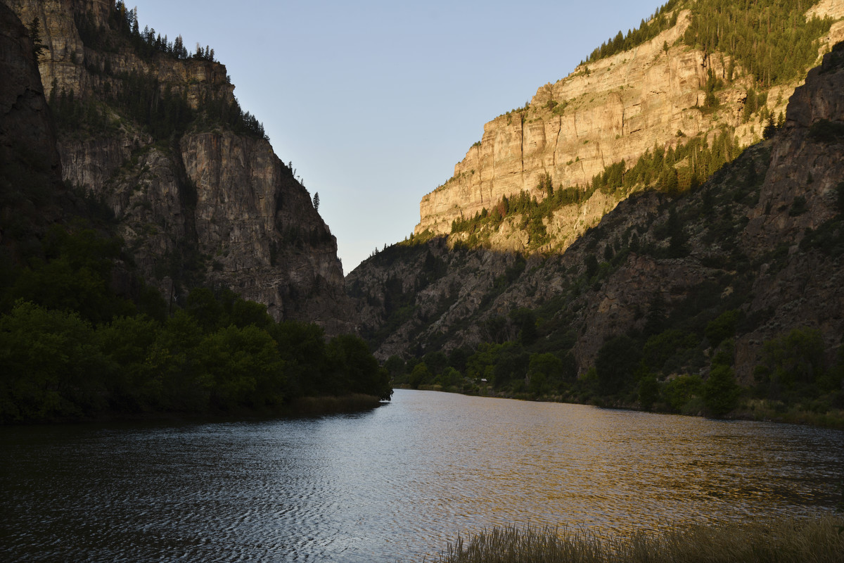
In this aerial photo, smoke, from the Pine Gulch Fires and the Grizzly Creek fires, fills the I-70 corridor looking west as the Colorado River shimmers in the light Tuesday, Aug. 24, 2020, in Glenwood Springs, Colo. The U.S. Department of Energy on Tuesday, Aug. 24, 2021, announced a new kind of climate observatory near the headwaters of the Colorado River that will help scientists better predict rain and snowfall in the U.S. West and determine how much of it will flow through the region. (Helen H. Richardson/The Denver Post via AP)
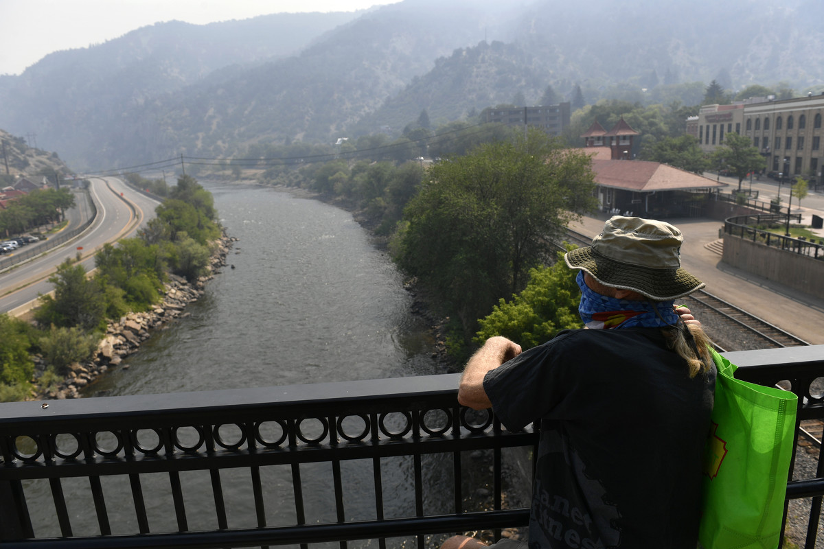
Craig, who only wanted his first name used, looks east towards an empty Highway I-70 closed due to the Grizzly Creek Fire and the Colorado River on Aug. 18, 2020, in Glenwood Springs, Colo. The U.S. Department of Energy on Tuesday, Aug. 24, 2021, announced a new kind of climate observatory near the headwaters of the Colorado River that will help scientists better predict rain and snowfall in the U.S. West and determine how much of it will flow through the region. (Helen H. Richardson/The Denver Post via AP)
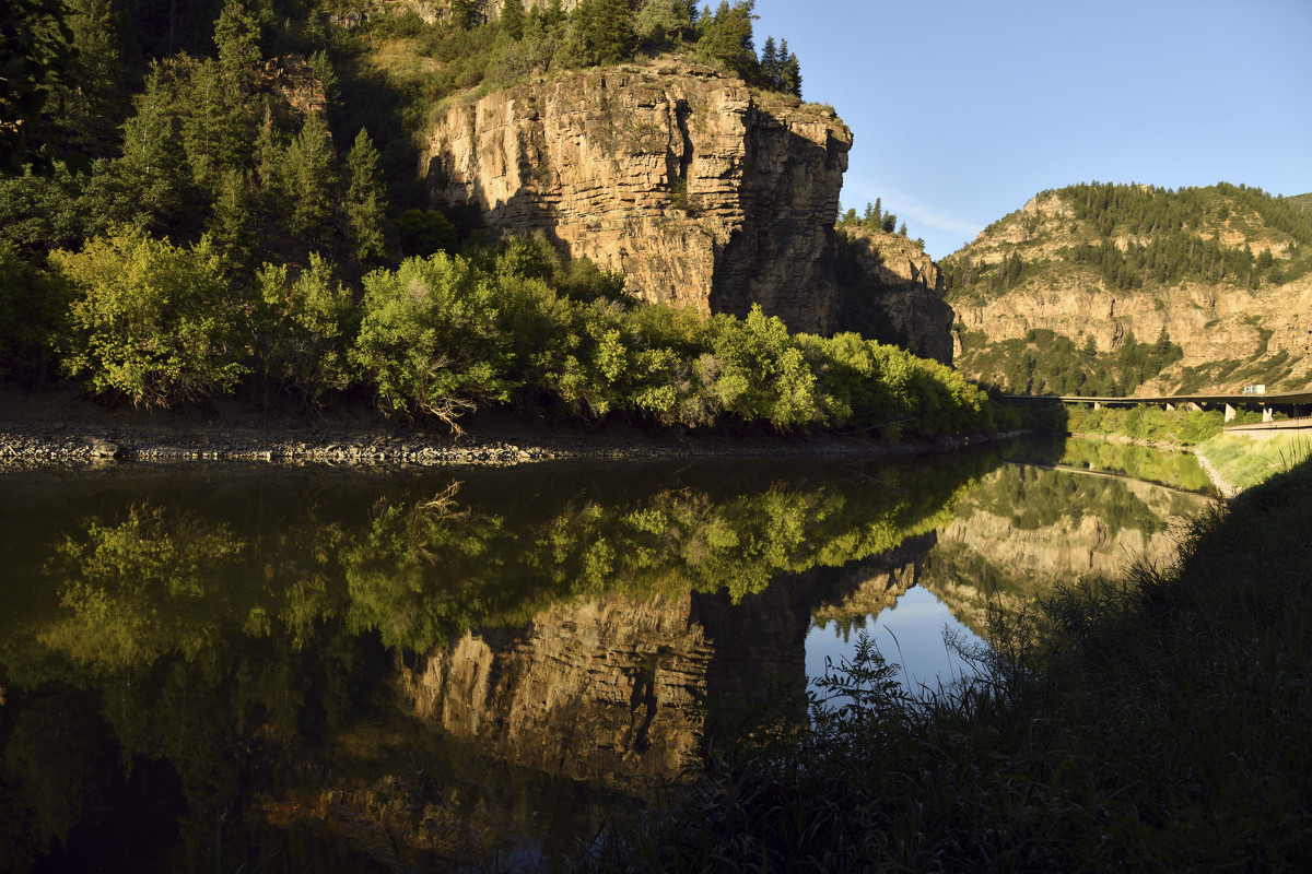
The Colorado River flows near Bair Ranch rest area in Glenwood Canyon on Thursday, Aug. 22, 2019, in Glenwood Springs, Colo. The U.S. Department of Energy on Tuesday, Aug. 24, 2021, announced a new kind of climate observatory near the headwaters of the Colorado River that will help scientists better predict rain and snowfall in the U.S. West and determine how much of it will flow through the region. (Hyoung Chang/The Denver Post via AP)
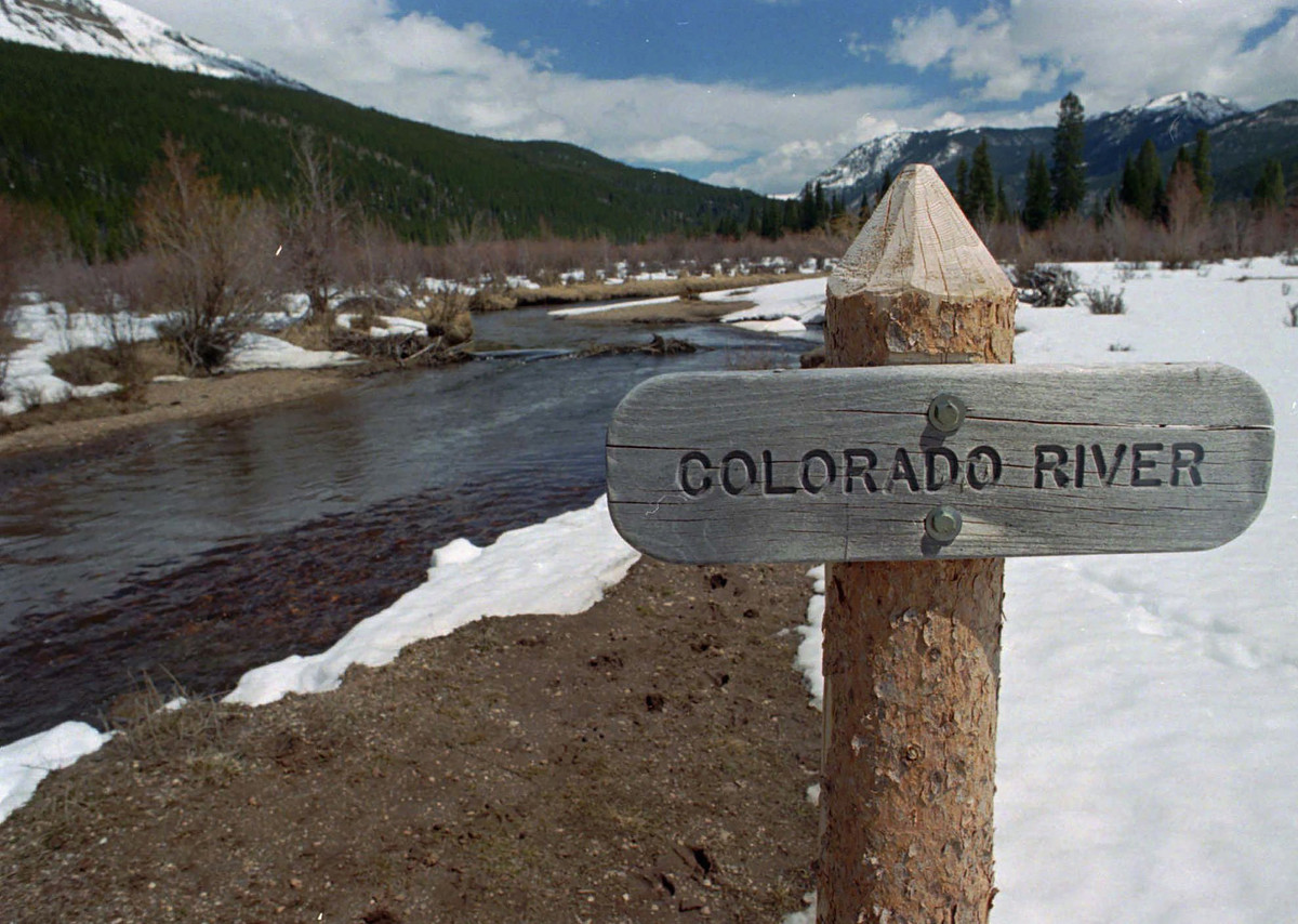
FILE - In this Thursday, May 1, 1997, file photograph, a sign marks the Colorado River as it flows past the Never Summer Mountains in Rocky Mountain National Park near the town of Grand Lake, Colo. The U.S. Department of Energy on Tuesday, Aug. 24, 2021, announced a new kind of climate observatory near the headwaters of the Colorado River that will help scientists better predict rain and snowfall in the U.S. West and determine how much of it will flow through the region. (AP Photo/David Zalubowski, File)
The Colorado River flows near Hanging Lake rest area in Glenwood Canyon on Thursday, Aug. 22, 2019, in Glenwood Springs, Colo. The U.S. Department of Energy on Tuesday, Aug. 24, 2021, announced a new kind of climate observatory near the headwaters of the Colorado River that will help scientists better predict rain and snowfall in the U.S. West and determine how much of it will flow through the region. (Hyoung Chang/The Denver Post via AP)
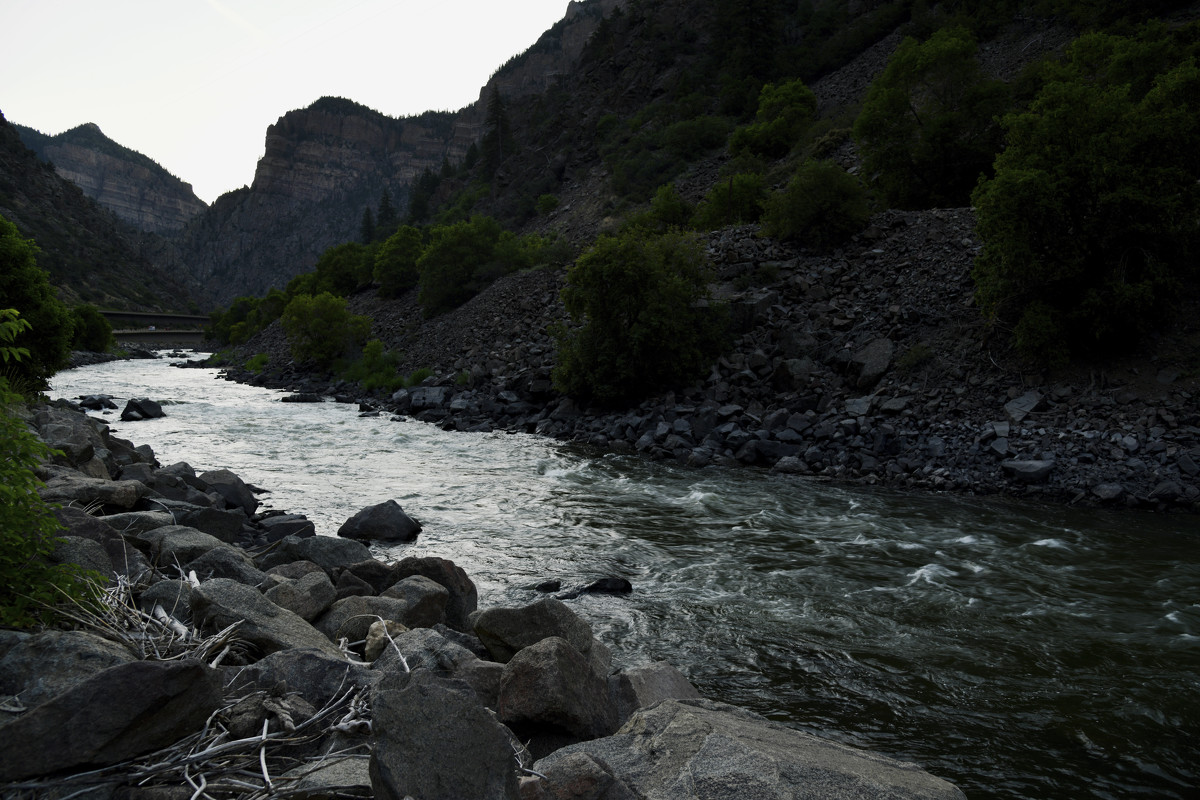
The Colorado River flows near Grizzly Creek Rest Area in Glenwood Canyon on Thursday, Aug. 22, 2019, in Glenwood Springs, Colo. The U.S. Department of Energy on Tuesday, Aug. 24, 2021, announced a new kind of climate observatory near the headwaters of the Colorado River that will help scientists better predict rain and snowfall in the U.S. West and determine how much of it will flow through the region. (Hyoung Chang/The Denver Post via AP)
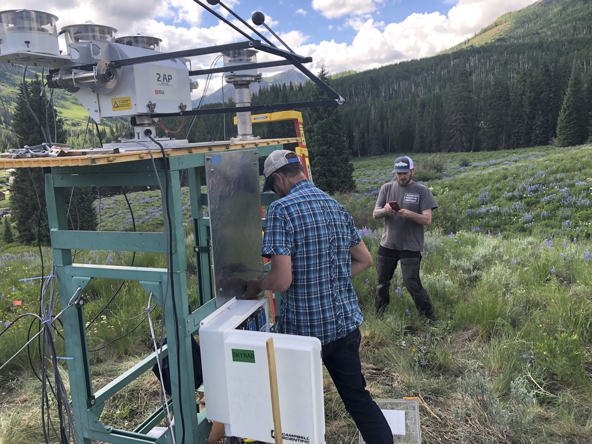
In this July 1, 2021, provided by Lawrence Berkeley National Laboratory, Heath Powers, center, site manager for the second Atmospheric Radiation Measurement mobile facility, helps set up radiometers for ARM's Surface Atmosphere Integrated Field Laboratory (SAIL) field campaign in Gothic, Colo. Federal scientists are launching an effort to better understand the hydrology in the U.S. West. The U.S. Department of Energy on Tuesday, Aug. 24 announced a new kind of climate observatory near the headwaters of the Colorado River. (David Chu/Lawrence Berkeley National Laboratory via AP)

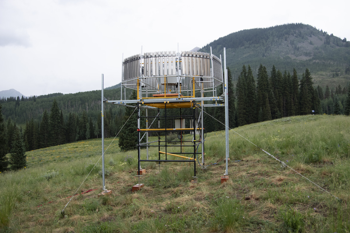
This Aug. 17, 2021 photo provided by Lawrence Berkeley National Laboratory shows Atmospheric Radiation Measurement instruments that will collect data from September to June 2023 during the Surface Atmosphere Integrated Field Laboratory (SAIL) campaign in Gothic, Colorado. The SAIL campaign will provide insights into mountainous water-cycle processes. Federal scientists are launching an effort to better understand the hydrology in the U.S. West. The U.S. Department of Energy on Tuesday, Aug. 24 announced a new kind of climate observatory near the headwaters of the Colorado River. (David Chu/Lawrence Berkeley National Laboratory via AP)
