The Daily Standard
World News

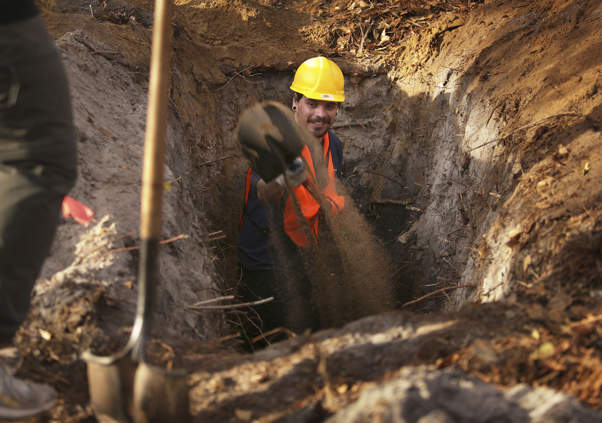
ODU graduate student Mauricio Gonzalez works on Rich Whittecar's research on sand dunes at First Landing. They dig deep into the sand to get samples that are old enough and date it to track what the landscape used to be like and information about the coastline history on Thursday, Dec. 16, 2021. (Stephen M. Katz/The Virginian-Pilot via AP)
VIRGINIA BEACH, Va. (AP) - Rich Whittecar isn't searching for Blackbeard's lost treasure in the sand dunes at First Landing State Park.
Some people seem to think that when they see him wearing a hard hat and carrying a shovel over his shoulder, he said.
Legend has it that the famed pirate's men "were all over here" in the early 1700s, including a time when Blackbeard himself buried treasure in the dunes while escaping back to his stronghold in North Carolina.
So when passersby see Whittecar and his team digging, it's a fair assumption.
But Whittecar, a 69-year-old geology professor emeritus at Old Dominion University, is fulfilling his own dream, one that began decades ago when he was "just a baby professor."
The goal: dating Cape Henry's ancient dunes.
Somewhere between 3,000-5,000 years ago, the slender sand crests were formed where the ocean's shoreline used to be. It happened as sea levels rose following the melting of ice age glaciers.
"The thing that's so neat for geologists out there is we have the trails set up along these long, skinny sand ridges all over the park," Whittecar said. "If you look at a map, they almost look like fingerprints."
ODU graduate student Mauricio Gonzalez works on Rich Whittecar's research on sand dunes at First Landing. They dig deep into the sand to get samples that are old enough and date it to track what the landscape used to be like and information about the coastline history on Thursday, Dec. 16, 2021. (Stephen M. Katz/The Virginian-Pilot via AP)
But no one knows exactly how old they are. Whittecar's estimate is based on best guesses given information about historic global sea levels.
Using newer technology, he and his team are hoping to learn a more precise date range.
"If you can figure out when the ridges actually formed, it will tell you about the coastline's history, sea level rise and more," he said. "I'm real interested in when those ridges formed."
___
On a beautiful afternoon in mid-December, Whittecar stepped off the main Cape Henry Trail. He was walking on the southernmost section along an inlet called Rainey Gut.
The southern side of the park is home to the oldest sand dunes, and that's where Whittecar and a handful of grad students were finishing the last dig of the project.
Whittecar rounded the corner to the site, which is lightly shielded from the main trail by trees. Just beyond, joggers, dog walkers and families moved past.
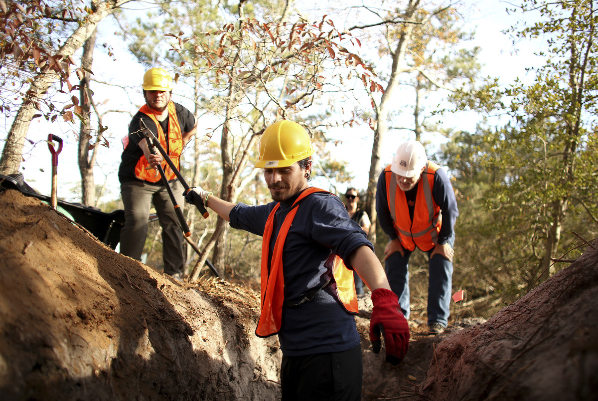
The three students - who volunteered as part of required fieldwork hours - were wearing orange construction vests and hard hats and were several hours into the dig.

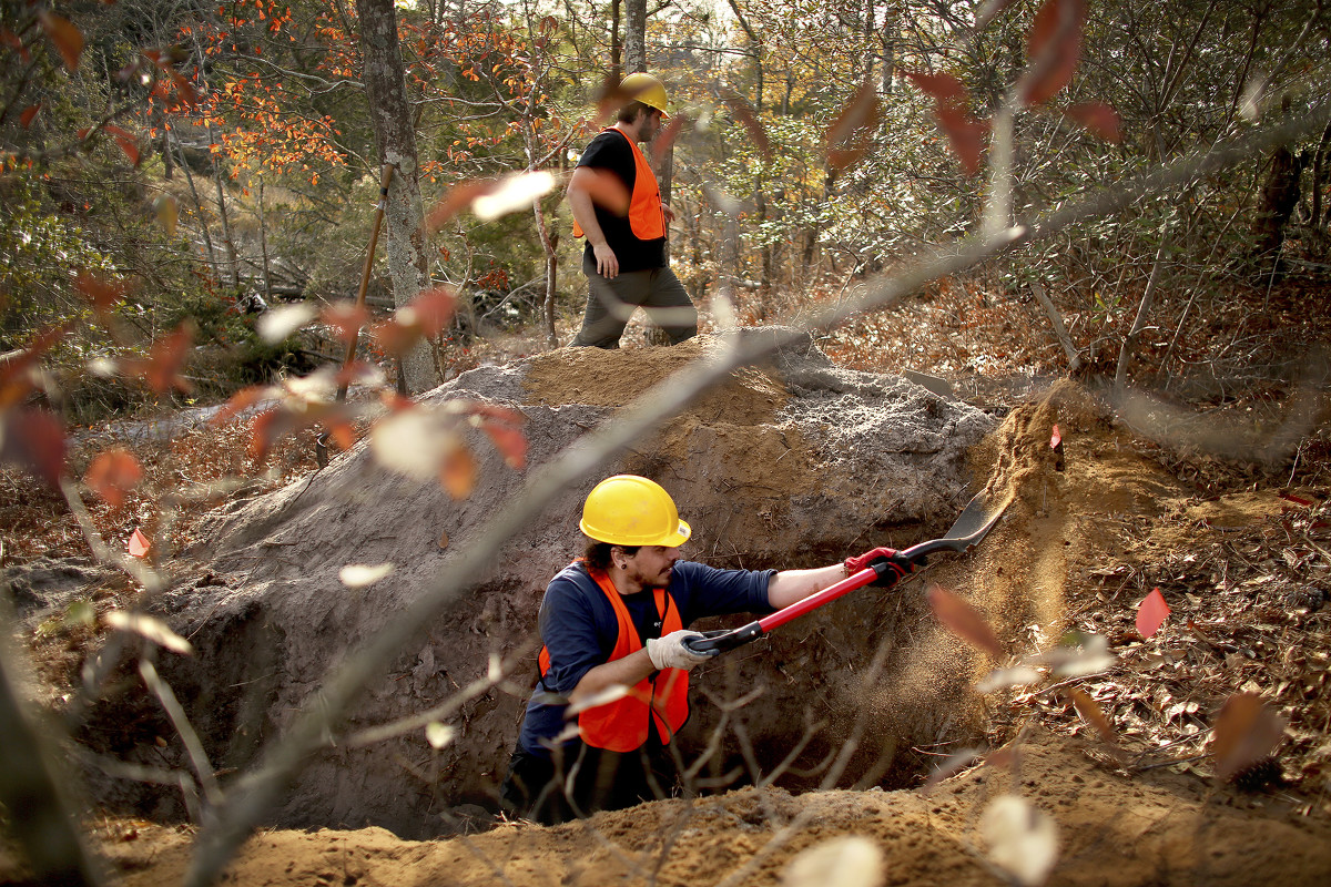
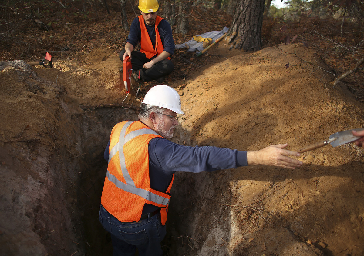
Rich Whittecar, left, ocean and earth science professor emeritus at ODU, works with three ODU graduate students on research on sand dunes at First Landing. They dig deep into the sand to get samples that are old enough and date it to track what the landscape used to be like and information about the coastline history on Thursday, Dec. 16, 2021. (Stephen M. Katz/The Virginian-Pilot via AP)
It looks remarkably like grave digging, they joked. But the team was looking for a layer of sediment deep enough - about 5 feet down - to have not seen the light of day in a long time.
When Whittecar started at ODU about 40 years ago, he tagged along on a soil surveying project at Cape Henry.
"I saw a lot of interesting things and thought it was a gorgeous place to work," he said.
Over the decades, he grew fascinated with the landscape and "learned how special it was."
Sand ridges are a common feature around inlets and barrier islands where there's a large supply of sediment, he said. But something about these kept him coming back for years.
After recently retiring from most teaching, Whittecar had time to fulfill his passion project.
Previously, it was hard to date the dunes because researchers relied on radiocarbon dating, which examines organic material to determine the levels of a radioactive isotope of carbon. Sand, however, doesn't usually have much organic material, he said.
A newer process called luminescence allows for dating based on the energy stored in the crystal structure of each grain of sand.
When the sand is buried beneath newer layers, as it decays, each grain absorbs ionizing radiation and its electrons get kicked out of position, Whittecar said.
Scientists in a lab can measure the amount of time that's passed based on that crystal structure since the sand last saw sunlight.
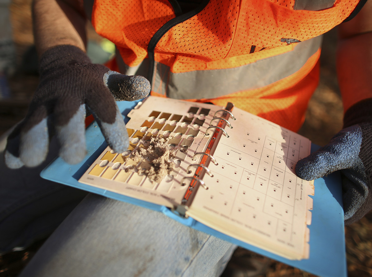
ODU graduate student Greg Joern establishes the color of the sand as part of Rich Whittecar's research on sand dunes at First Landing. They dig deep into the sand to get samples that are old enough and date it to track what the landscape used to be like and information about the coastline history on Thursday, Dec. 16, 2021. (Stephen M. Katz/The Virginian-Pilot via AP)
In December, after the students dug deep enough, they used a sheet of colors not unlike paint samples to ensure the sand matched with what they wanted. It was time to get the main sample.
Whittecar climbed into the hole. The students then put a black sheet over him to prevent light exposure as he stuck a tube into the deepest side of the hole.
He wrapped it in foil and black tape, and they were good to go. The students started filling the hole back in.
Throughout last year, Whittecar's group dug at seven sites throughout the park. The sand samples now await luminescence dating at a lab in Illinois.
___
The dunes at First Landing hold a lot of history.
There's the Blackbeard legend.
Colonists also found harbor in Crystal Lake and its protective sand dunes, according to Pilot archives. They encountered Chesapeake Indians who "retreated into the sand hills after being fired on by" ship cannons, according to a historical account on the Cavalier Park/Bay Colony Civic League website.
The dunes also can prove relevant in present day.
After Hurricane Matthew swept through in 2016, the sand absorbed much of the excess moisture - then released it five days later, causing heavy flooding.
Whittecar said he knows his research won't be a decisive factor in immediate policymaking or engineering decisions related to sea level rise.
But from an academic standpoint, it will help officials learn what happened while sea levels were creeping up thousands of years ago, he said. He expects to get the results sometime this year.
"We'll have to wait and see what dates come back, and what story there is to make sense of those dates."
He's hoping the ridges at least line up from oldest to youngest, as he assumes.
"If they don't, then I'll really have to start scratching my head."
ODU graduate student Mauricio Gonzalez works on Rich Whittecar's research on sand dunes at First Landing. They dig deep into the sand to get samples that are old enough and date it to track what the landscape used to be like and information about the coastline history on Thursday, Dec. 16, 2021. (Stephen M. Katz/The Virginian-Pilot via AP)
Rich Whittecar, ocean and earth science professor emeritus at ODU, is leading research on sand dunes at First Landing. They dig deep into the sand to get samples that are old enough and date it to track what the landscape used to be like and information about the coastline history on Thursday, Dec. 16, 2021. (Stephen M. Katz/The Virginian-Pilot via AP)
