Heat Advisory issued June 24 at 8:36PM EDT until June 25 at 8:00PM EDT by NWS Wilmington OH (details ...)
* WHAT...Heat index values of 100 to 104.
* WHERE...Portions of east central and southeast Indiana, northeast and northern Kentucky and central, south central, southwest and west central Ohio.
* WHEN...Until 8 PM EDT Wednesday.
* IMPACTS...Hot temperatures and high humidity may cause heat illnesses to occur.
* ADDITIONAL DETAILS...Consecutive days of high heat and humidity can be especially hazardous as warm overnight temperatures will provide little relief.
74° 74° slight chance Wed 89° Wed 89° chance likely 73° 73° likely chance Thu 89° Thu 89° slight chance likely
Thursday, June 14th, 2007
Wishful thinking?
Photo by Shelley Grieshop/The Daily Standard

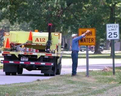
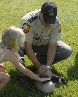
A worker with the Grand Lake St. Marys State Park puts up a permanent high water sign along Edgewater Drive where the roadway frequently floods during heavy rains. However, that hasn't been the case lately. No rain is currently in the forecast until a slight chance on Tuesday and highs will remain near the 90-degree mark, according to local weather forecaster Dennis Howick.

Additional pictures on this date