Flood Advisory issued August 10 at 10:45PM EDT until August 11 at 1:45AM EDT by NWS Wilmington OH (details ...)
* WHAT...Flooding caused by excessive rainfall is expected.
* WHERE...Northwestern Auglaize County in west central Ohio... Northern Mercer County in west central Ohio...
* WHEN...Until 145 AM EDT.
* IMPACTS...Minor flooding in low-lying and poor drainage areas.
* ADDITIONAL DETAILS... - At 1045 PM EDT, radar indicated heavy rain due to thunderstorms. Minor flooding is ongoing or expected to begin shortly in the advisory area. Between 0.5 and 2 inches of rain have fallen. Additional rainfall amounts up to 2 inches are possible. - Some locations that may experience flooding include... Celina, St. Marys, Rockford, Moulton, Mendon, Buckland, Neptune, Tama, State Route 116 at State Route 197, Kossuth and Chattanooga.
Severe Thunderstorm Watch issued August 10 at 7:26PM EDT until August 11 at 2:00AM EDT by NWS Wilmington OH (details ...)
THE NATIONAL WEATHER SERVICE HAS ISSUED SEVERE THUNDERSTORM WATCH 560 IN EFFECT UNTIL 2 AM EDT TUESDAY FOR THE FOLLOWING AREAS
IN INDIANA THIS WATCH INCLUDES 1 COUNTY
IN EAST CENTRAL INDIANA
WAYNE
IN OHIO THIS WATCH INCLUDES 21 COUNTIES
IN CENTRAL OHIO
DELAWARE FAIRFIELD FAYETTE FRANKLIN HOCKING LICKING MADISON PICKAWAY UNION
IN WEST CENTRAL OHIO
AUGLAIZE CHAMPAIGN CLARK DARKE GREENE HARDIN LOGAN MERCER MIAMI MONTGOMERY PREBLE SHELBY
THIS INCLUDES THE CITIES OF ADA, BEAVERCREEK, BELLEFONTAINE, CAMDEN, CELINA, CIRCLEVILLE, COLDWATER, DELAWARE, DOWNTOWN COLUMBUS, DOWNTOWN DAYTON, EATON, FAIRBORN, GREENVILLE, KENTON, KETTERING, LANCASTER, LOGAN, LONDON, MARYSVILLE, MINSTER, NEW BREMEN, NEWARK, PICKERINGTON, PIQUA, PLAIN CITY, RICHMOND, SIDNEY, SPRINGFIELD, ST. MARYS, TIPP CITY, TROY, URBANA, WAPAKONETA, WASHINGTON COURT HOUSE, WEST JEFFERSON, AND XENIA.
Flood Watch issued August 10 at 1:04PM EDT until August 12 at 8:00AM EDT by NWS Wilmington OH (details ...)
* WHAT...Flash flooding caused by excessive rainfall is possible.
* WHERE...Portions of Indiana, including the following counties, Dearborn, Fayette, Franklin, Union and Wayne, Kentucky, including the following counties, Boone, Bracken, Campbell, Kenton, Lewis, Mason, Pendleton and Robertson, and Ohio, including the following counties, Adams, Auglaize, Brown, Butler, Champaign, Clark, Clermont, Clinton, Darke, Delaware, Fairfield, Fayette, Franklin, Greene, Hamilton, Hardin, Highland, Hocking, Licking, Logan, Madison, Mercer, Miami, Montgomery, Pickaway, Pike, Preble, Ross, Scioto, Shelby, Union and Warren.
* WHEN...Through Wednesday morning.
* IMPACTS...Excessive runoff may result in flooding of rivers, creeks, streams, and other low-lying and flood-prone locations.
* ADDITIONAL DETAILS... - Several rounds of thunderstorms are expected through Tuesday night. Locally heavy rainfall can be expected with the potential for storms to repeatedly track over the same locations. This will result in the potential for flash flooding.
Flash Flood Warning issued August 10 at 11:11PM EDT until August 11 at 1:30AM EDT by NWS Wilmington OH (details ...)
At 1111 PM EDT, radar indicated thunderstorms producing heavy rain across the warned area. Between 2 and 4 inches of rain have fallen. Additional rainfall amounts up to 1 inch are possible. Flash flooding is ongoing or expected to begin shortly.
HAZARD...Flash flooding caused by thunderstorms.
SOURCE...Radar indicated.
IMPACT...Flash flooding of small creeks and streams, urban areas, highways, streets and underpasses as well as other poor drainage and low-lying areas.
Some locations that may experience flash flooding include... Bellefontaine, Kenton, West Liberty, Russells Point, De Graff, Lakeview, Waynesfield, Belle Center, West Mansfield, Chippewa Park, Northwood, Roundhead, Quincy, Mount Victory, Rushsylvania, Huntsville, Ridgeway, Valley Hi, Zanesfield and Big Springs.
69° 69° chance Tue 82° Tue 82° likely 66° 66° likely Wed 82° Wed 82° chance
Monday, June 25th, 2007
By Margie Wuebker
MARIA STEIN - Laurie Tournoux and Ron McDonald put on quite a show at the 20th annual Country Fest turning 10 to 12 tons of sand into a work of art.
The master sand sculptors set to work Friday afternoon and finished just before noon Sunday, sharing an enthusiastic high five as they viewed their handiwork - a massive pair of hands folded in prayer and a church with towering steeple atop a rock foundation. [More]
By Gary R. Rasberry
First a Flyer, then a Buckeye, now an Emerald.
Within a few years, Cory Luebke is hoping to become a Padre.
The Marion Local graduate, the 63rd pick of the 2007 Major League Baseball Amateur Draft, officially signed his deal with the San Diego Padres on Saturday and headed west to begin his professional baseball career. [More]
Obituaries on June 25th, 2007
Ruth E. Peters, 84, of Celina, died at 8:05 a.m. June 23, 2007, at Celina Manor Nursing Home. [More]
Lawrence Frank "Barney" Puthoff, 89, 25 Liberty St., Chickasaw, died June 23, 2007, at his residence. [More]
Ann Rabe, 85, of Fort Recovery, died June 23, 2007, at her residence.
Arrange [More]
Local pictures on June 25th, 2007
Subscriber stories on June 25th, 2007
College students may be able to get larger grants and pay less for college loans if two similar reform bills pending in the U.S. House and Senate are approved next month.
A case of tuberculosis (TB) has been diagnosed in a patient at Mercer County Community Hospital in Coldwater, although further testing is underway to determine if the initial test is valid and specifics about the type of the disease.

Celina city officials plan to begin saving for a new fire truck in the next few years.
Celina City Council members at tonight's meeting will consid
It was one of those days that got better as the day went along.
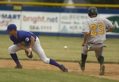
After suffering a 4-1 loss in the opening game of Saturday's doubleheader with Southern Ohio, Grand Lake rebounded behind the arm of Brad Piatt.
Compiled by Gary R. Rasberry
Coldwater faced off with a solid Paulding squad in ACME doubleheader action on Saturday at Veterans Field and was swept.