Winter Weather Advisory issued February 5 at 4:04PM EST until February 6 at 6:00PM EST by NWS Wilmington OH (details ...)
* WHAT...Snow expected. Total snow accumulations up to two inches with locally higher amounts.
* WHERE...Portions of east central and southeast Indiana, northeast and northern Kentucky, and central, south central, southwest, and west central Ohio.
* WHEN...From 6 AM to 6 PM EST Friday.
* IMPACTS...Plan on slippery road conditions. The hazardous conditions could impact the Friday morning and evening commutes.
Today 21° Today 21° chance 18° 18° chance Tomorrow 33° Tomorrow 33° light likely
Tuesday, February 5th, 2008
No place for cars
Photo by Mark Pummell/The Daily Standard

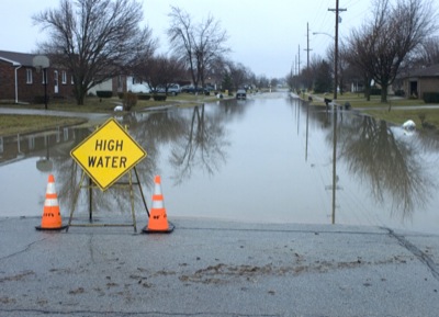
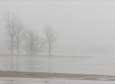
Some roadways throughout the county were covered in water this morning after heavy thunderstorms dumped more than 2 inches of rain Monday night, according to local weather forecaster Dennis Howick. A high water sign warns motorists at the intersection of Jill Avenue and Fairground Road in Celina. Flooded basements were reported in Celina, Coldwater, Fort Recovery and Rockford with the National Weather Service issuing a flood watch through 9 a.m. Wednesday. Temperatures will drop overnight with Wednesday's forecast calling for showers, possible snow flurries and a high of 37.

Additional pictures on this date