Special Weather Statement issued November 10 at 2:15AM EST by NWS Wilmington OH (details ...)
Light snow across the area early this morning will increase in coverage and intensity toward sunrise in the I-70 corridor. This band of moderate snow will push south affecting the Tri-State region by mid morning, eventually pushing south of the area by early to mid afternoon.
Snow amounts of 1-2 inches will common for a good portion of the area on grassy surfaces, with melting on concrete surfaces limiting accumulations. Main impacts are expected to be reduced visibilities and some slick spots on mainly bridges and overpasses.
Temperatures today will remain steady mainly in the upper 20s. These cold temperatures combined with gusty winds of 20-25 mph will result in wind chill values in the teens to lower 20s.
Motorists should exercise caution. Plan extra time for the Monday morning commute.
25° 25° Mon 32° Mon 32° 22° 22° likely Tue 39° Tue 39° slight chance
Monday, April 14th, 2008
Photo by Mark Pummell/The Daily Standard

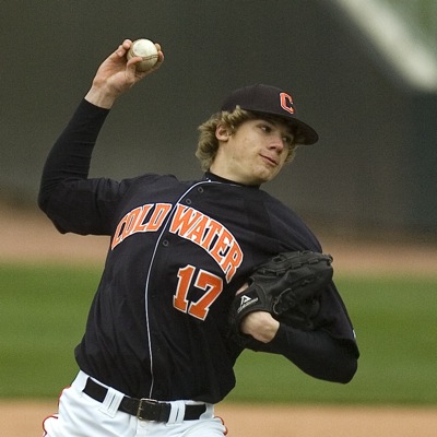
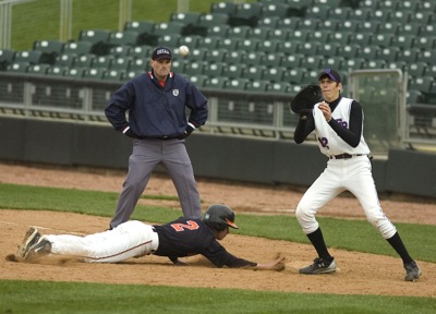
Coldwater pitcher Bill Geeslin fires the ball to home plate during the Cavaliers' Midwest Athletic Conference contest on Saturday at Dayton's Fifth Third Field. Geeslin allowed just three hits in five innings of work as the Cavaliers knocked off the Indians, 8-0.

Related online story:
DAYTON - Judging by their play on Saturday, Coldwater is just as comfortable at Fifth Third Field as they are at Veterans Field.
Cavalier ace Bill [More]
Additional pictures on this date