Special Weather Statement issued May 1 at 8:06PM EDT by NWS Wilmington OH (details ...)
At 806 PM EDT, a strong thunderstorm was located over Monroe, moving northeast at 35 mph. HAZARD...Wind gusts up to 45 mph and pea size hail. SOURCE...Radar indicated. IMPACT...Gusty winds could knock down tree limbs and blow around unsecured objects. Hail may cause minor damage to vegetation. This storm will remain over mainly rural areas of northwestern Mercer County. If outdoors, consider seeking shelter inside a sturdy building. To report hazardous weather conditions, go to our website at weather.gov/iln and submit your report via social media, when you can do so safely.
Saturday, June 20th, 2009
Photo by Dave Heirholzer/The Daily Standard
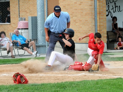
New Bremen's Kyle Bruggeman slides safely into home as St. Henry catcher Nathan Uhlenhake snags the ball during Friday's ACME game at St. Henry. The Cardinals beat the Redskins 11-1 to improve to 9-4 on the season.