Special Weather Statement issued May 1 at 8:06PM EDT by NWS Wilmington OH (details ...)
At 806 PM EDT, a strong thunderstorm was located over Monroe, moving northeast at 35 mph. HAZARD...Wind gusts up to 45 mph and pea size hail. SOURCE...Radar indicated. IMPACT...Gusty winds could knock down tree limbs and blow around unsecured objects. Hail may cause minor damage to vegetation. This storm will remain over mainly rural areas of northwestern Mercer County. If outdoors, consider seeking shelter inside a sturdy building. To report hazardous weather conditions, go to our website at weather.gov/iln and submit your report via social media, when you can do so safely.
Friday, October 26th, 2012
Pumpkin guts and seeds
Photo by Shelley Grieshop/The Daily Standard
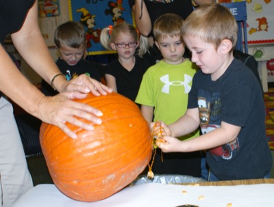
Mason Homan, a student at Creative Discovery Preschool in Celina, removes a handful of seeds and pulp from a pumpkin Thursday morning, as his classmates watch. The students learned how to prepare and bake pumpkin seeds during the fall activity.