Special Weather Statement issued December 3 at 5:13AM EST by NWS Wilmington OH (details ...)
Light snow is expected to develop across the area after midnight, shifting to the southeast through the predawn hours. This band of light snow will affect the Tri-State region by the Thursday morning commute, eventually pushing south of the area by mid- morning. Minor snow accumulations of less than an inch are expected, but cold ground conditions will allow for quick accumulation on any untreated surfaces. The main impacts are expected to be reduced visibilities and some slick spots on untreated surfaces. Motorists should exercise caution. Plan extra time for the Thursday morning commute.
Thursday, July 11th, 2013
Photo by Mark Pummell/The Daily Standard
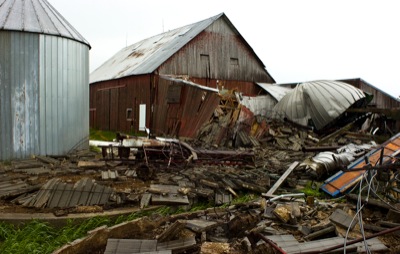
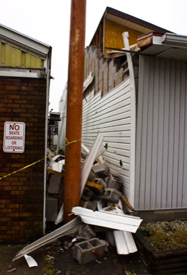
A 70-foot by 20-foot silo and a 60-foot by 20-foot silo made of concrete blocks were destroyed by winds on Wednesday at Frank and Carol Vagedes' farm at 2560 Philothea Road.
The powerful storm that ripped through Mercer and Auglaize counties Wednesday afternoon was akin to a weak tornado, reported Mike Kurz, a meteorologist with the National Weather Service in Wilmington. [More]