Special Weather Statement issued December 19 at 1:40AM EST by NWS Wilmington OH (details ...)
An arctic cold front will move quickly east across the region through daybreak. This will usher in a much colder airmass with temperatures quickly falling below freezing. Snow showers can be expected this morning with snow accumulations of a half inch or less possible. This will combine with the falling temperatures to produce slick spots on untreated roadways. In addition, brisk west winds will gust to 25 to 35 mph at times this morning. The morning commute will be affected by these conditions. Please allow for some extra time to reach your destination. Be prepared for slick spots, especially on bridges an overpasses.
Tuesday, July 16th, 2013
Photo by Margie Wuebker/The Daily Standard
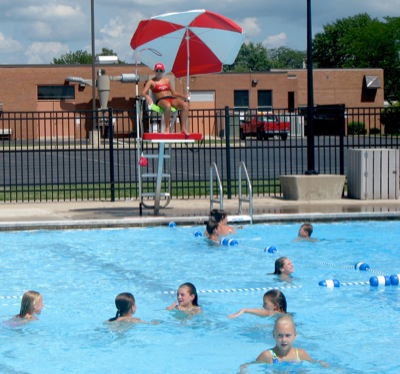
Swimmers beat the heat Monday afternoon with lifeguard Nikki Borgerding keeping watch at the Minster Swimming Pool. Temperatures will stay in the 90s through Friday, local weather forecaster Dennis Howick reported.
High temperatures in the 90s and stifling humidity are predicted through Friday night, making the next four days the hottest yet this summer. The heat index likely will hit the three-digit mark, forecasters said. [More]