Severe Thunderstorm Watch issued May 18 at 11:11AM EDT until May 18 at 6:00PM EDT by NWS Wilmington OH (details ...)
THE NATIONAL WEATHER SERVICE HAS ISSUED SEVERE THUNDERSTORM WATCH 220 IN EFFECT UNTIL 6 PM EDT THIS EVENING FOR THE FOLLOWING AREAS
IN OHIO THIS WATCH INCLUDES 2 COUNTIES
IN WEST CENTRAL OHIO
AUGLAIZE MERCER
THIS INCLUDES THE CITIES OF CELINA, COLDWATER, MINSTER, NEW BREMEN, ST. MARYS, AND WAPAKONETA.
Today 87° Today 87° chance 68° 68° chance Tomorrow 87° Tomorrow 87° likely 59° 59°
Wednesday, October 16th, 2013
Foggy farm shot
Photo by Mark Pummell/The Daily Standard

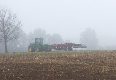
A farm tractor and plow sit in a foggy field along Fairground Road west of Celina Tuesday morning. Tonight and Thursday will be mostly cloudy with showers. The low tonight will reach 44 and Thursday's high will be 56, said local weatherman Dennis Howick.

Additional pictures on this date