Special Weather Statement issued May 1 at 8:06PM EDT by NWS Wilmington OH (details ...)
At 806 PM EDT, a strong thunderstorm was located over Monroe, moving northeast at 35 mph.
HAZARD...Wind gusts up to 45 mph and pea size hail.
SOURCE...Radar indicated.
IMPACT...Gusty winds could knock down tree limbs and blow around unsecured objects. Hail may cause minor damage to vegetation.
This storm will remain over mainly rural areas of northwestern Mercer County.
If outdoors, consider seeking shelter inside a sturdy building.
To report hazardous weather conditions, go to our website at weather.gov/iln and submit your report via social media, when you can do so safely.
57° 57° likely slight chance Fri 72° Fri 72° chance 53° 53° likely Sat 59° Sat 59° likely
Tuesday, July 29th, 2014
Photo by Kathy Thompson/The Daily Standard

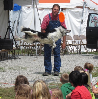
Smudge, a 5-year-old Border collie, impressed children at the Auglaize County Fair on Monday with his acrobatics while catching Frisbees. Farmer John Forshee owns and trains Smudge and uses him to teach children how to care for animals.

Additional pictures on this date