The Daily Standard
Pictures Archive

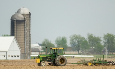
A farmer plows a field earlier this week just off state Route 119 near St. Henry. Mercer County farmers have sown a small amount of corn and a smaller amount of soybeans, said Chris Gibbs, executive director of the Mercer County Farm Service Agency. Recent wet conditions have slowed planting but farmers are still "right on schedule" and many are likely to take advantage of today's sunny conditions, he added. Local weatherman Dennis Howick predicts a high of 82 degrees Friday with scattered showers developing. Rain is forecast for Saturday through Monday, Howick said.