Severe Thunderstorm Watch issued March 31 at 6:02PM EDT until April 1 at 12:00AM EDT by NWS Wilmington OH (details ...)
THE NATIONAL WEATHER SERVICE HAS ISSUED SEVERE THUNDERSTORM WATCH 82 IN EFFECT UNTIL MIDNIGHT EDT TONIGHT FOR THE FOLLOWING AREAS
IN OHIO THIS WATCH INCLUDES 3 COUNTIES
IN WEST CENTRAL OHIO
AUGLAIZE HARDIN MERCER
THIS INCLUDES THE CITIES OF ADA, CELINA, COLDWATER, KENTON, MINSTER, NEW BREMEN, ST. MARYS, AND WAPAKONETA.
Today 78° Today 78° chance 52° 52° chance Tomorrow 60° Tomorrow 60° 47° 47° likely
Monday, June 22nd, 2015
Photo by Kathy Thompson/The Daily Standard

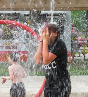
Olivia Shifferly, 13, of Decatur, Ind., gets soaked on Saturday by buckets of water at the Shanes Park splash pad during Rockford Community Days.

Additional pictures on this date