Special Weather Statement issued June 6 at 9:56AM EDT by NWS Wilmington OH (details ...)
At 955 AM EDT, a strong thunderstorm was located over Fort Recovery, moving east at 60 mph.
HAZARD...Wind gusts up to 45 mph.
SOURCE...Radar indicated.
IMPACT...Gusty winds could knock down tree limbs and blow around unsecured objects.
Locations impacted include... Greenville, Celina, Wapakoneta, St. Marys, Coldwater, New Bremen, Minster, Versailles, Covington, St. Henry, Newport, Bradford, Union City, Fort Loramie, Fort Recovery, Ansonia, Botkins, New Knoxville, Moulton, and Webster.
This includes I-75 in Ohio between mile markers 105 and 110.
If outdoors, consider seeking shelter inside a sturdy building.
To report hazardous weather conditions, go to our website at weather.gov/iln and submit your report via social media, when you can do so safely.
Today 82° Today 82° likely 67° 67° slight chance Tomorrow 81° Tomorrow 81° slight chance 67° 67° slight chance
Thursday, February 23rd, 2017
Submitted Photo

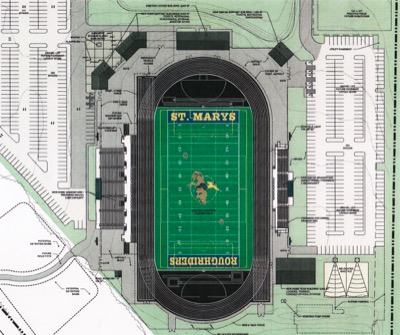
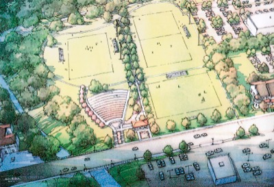
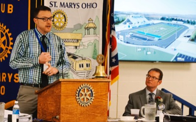
Planners on Wednesday shared conceptual drawings of a possible new stadium on the St. Marys High School campus. The drawing is the most recent plan if private funding is raised to build a new facility. Specific stadium features are still under discussion. The stadium could be open in time for the 2018 football season.

Related online story:
ST. MARYS - Fundraising has begun to construct a new football stadium at the high school/middle school property.
Dan Burke, secretary/treasurer of [More]
Additional pictures on this date