Flood Watch issued April 5 at 4:53AM EDT until April 6 at 8:00AM EDT by NWS Wilmington OH (details ...)
* WHAT...Flooding caused by excessive rainfall continues to be possible.
* WHERE...The following counties, in Indiana, Dearborn, Fayette, Franklin, Ohio, Ripley, Switzerland, Union and Wayne, the following counties, in Kentucky, Boone, Bracken, Campbell, Carroll, Gallatin, Grant, Kenton, Lewis, Mason, Owen, Pendleton and Robertson, and the following counties, in Ohio, Adams, Auglaize, Brown, Butler, Champaign, Clark, Clermont, Clinton, Darke, Delaware, Fairfield, Fayette, Franklin, Greene, Hamilton, Hardin, Highland, Hocking, Licking, Logan, Madison, Mercer, Miami, Montgomery, Pickaway, Pike, Preble, Ross, Scioto, Shelby, Union and Warren.
* WHEN...Through Sunday morning.
* IMPACTS...Excessive runoff may result in flooding of rivers, creeks, streams, and other low-lying and flood-prone locations.
* ADDITIONAL DETAILS... - Moderate to heavy rainfall will continue into Sunday, with the heaviest rainfall expected Saturday afternoon into Saturday night.
48° 48° Sat 62° Sat 62° 37° 37° Sun 44° Sun 44° chance
Monday, March 11th, 2019
Submitted Photo

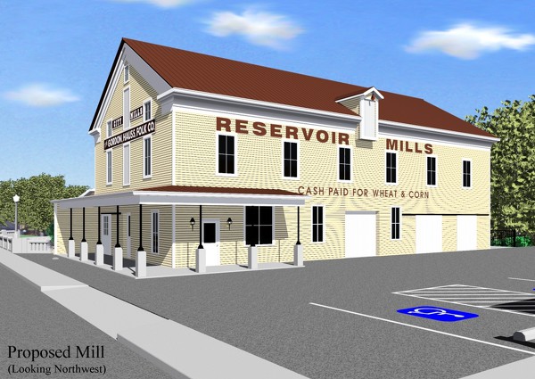
Shown is an early rendering of plans for the restoration of the Reservoir Mill on East High Street in St. Marys. Some details have changed since this early illustration was made.

Additional pictures on this date