The Daily Standard
Pictures Archive
Menu
▼
Home
Subscribe
E-Edition
Archives
▼
Archives
Obituary Archives
Photo Albums
Podcasts
▼
Podcasts
Video
Classifieds
▼
Classifieds
Public Notices
Weather
Sports
More
▼
Contacts
Advertising
Subscription Payment
Community Pictures
Historical Maps
Forms
Locations
Elections
57°
57°
Sat
78°
Sat
78°
58°
58°
Sun
70°
Sun
70°
likely
Saturday, April 6th, 2019
Photo by Dan Melograna/The Daily Standard
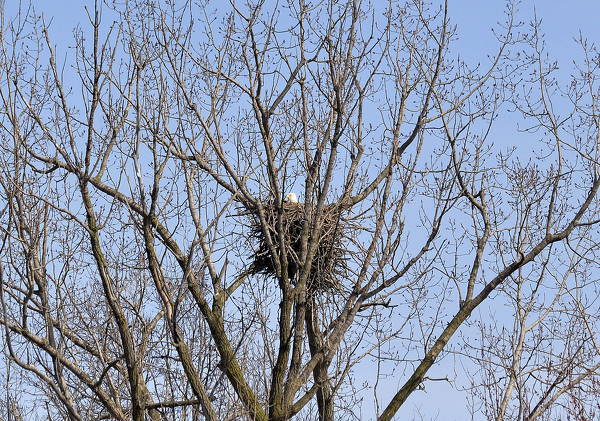
An eagle gazes out from its nest in a tree near U.S. 127 south of Celina on Wednesday.
Related online story:
Grand Lake bald eagle population still thriving
CELINA - Bald eagles in the area continue to thrive with at least 11 nests in Mercer and Auglaize counties.
The number of nests have steadily incre [
More
]
Purchase a print of this photo.
Archive of April 6th, 2019
Buy this E-Edition
Additional pictures on this date
<!--Unsupported browser-->
Copyright © 2026 Standard Printing Co. All Rights Reserved