The Daily Standard
Pictures Archive

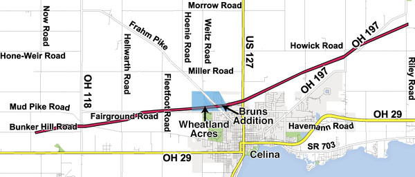
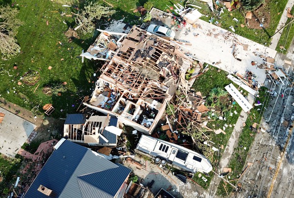
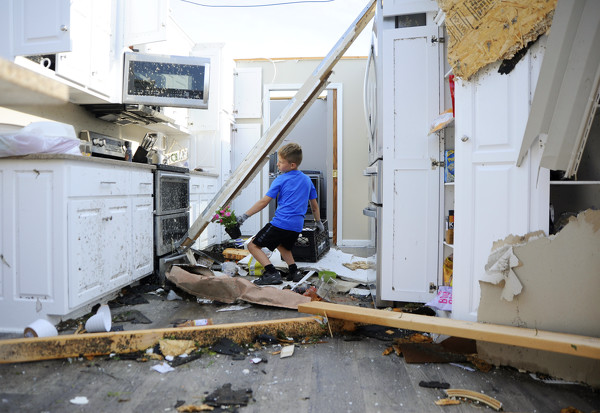
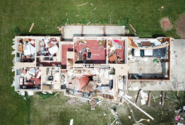
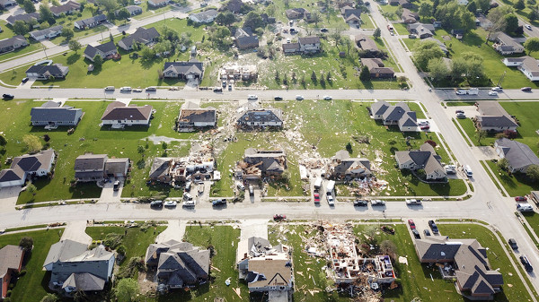
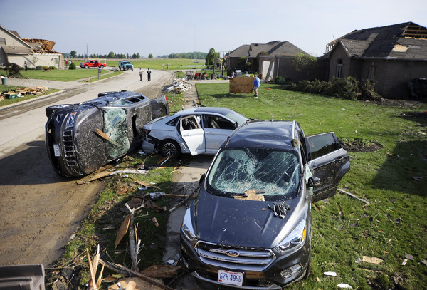
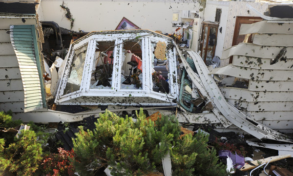
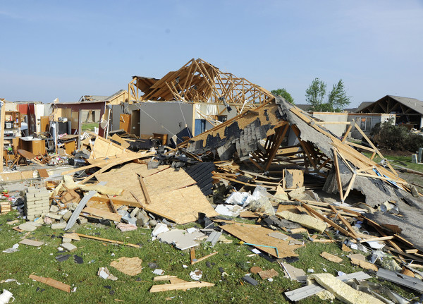
This map shows the path of destruction of Monday night's EF3 tornado. The roughly 10-mile path began along Bunker Hill Road and then traveled slightly northeast and ended near Neptune.
Related online story: