Special Weather Statement issued April 19 at 9:54AM EDT by NWS Wilmington OH (details ...)
At 954 AM EDT, a strong thunderstorm was located near Newport, moving east at 55 mph. HAZARD...Wind gusts up to 40 mph and pea size hail. SOURCE...Radar indicated. IMPACT...Gusty winds could knock down tree limbs and blow around unsecured objects. Hail may cause minor damage to vegetation. Locations impacted include... Montra, Newbern, New Jerusalem, Lockington, Ridgeway, Woodstock, Botkins, Mount Victory, Millerstown, Kiser Lake State Park, Hardin, Pemberton, Piqua, West Mansfield, East Liberty, St. Paris, Logansville, Belle Center, North Lewisburg, and Lakeview. This includes I-75 in Ohio between mile markers 77 and 106. If outdoors, consider seeking shelter inside a sturdy building. To report hazardous weather conditions, go to our website at weather.gov/iln and submit your report via social media, when you can do so safely.
Friday, February 7th, 2020
Photo by Dan Melograna/The Daily Standard
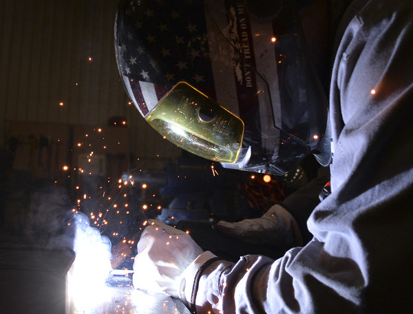
Trent Paulus, a welder at Duesway Inc. in Celina, carefully uses high heat to melt together two pieces of metal Thursday at the facility.
A national shortage of welders is expected in the near future as many workers are nearing retirement, but local business officials say they are already feeling the pinch. [More]