Special Weather Statement issued April 2 at 8:39AM EDT by NWS Wilmington OH (details ...)
At 839 AM EDT, a strong thunderstorm was located near Union City, moving northeast at 60 mph.
HAZARD...Wind gusts up to 40 mph and half inch hail.
SOURCE...Radar indicated.
IMPACT...Gusty winds could knock down tree limbs and blow around unsecured objects. Hail may cause minor damage to vegetation.
Locations impacted include... New Weston, Fryburg, Chickasaw, New Bremen, Fort Recovery, Botkins, New Knoxville, State Route 47 at US Route 127, Eldora Speedway, Neptune, Fort Loramie, Osgood, Moulton, Coldwater, Sharps Crossing, Kossuth, Lake Loramie State Park, North Dayton, Waynesfield, and Minster.
This includes I-75 in Ohio between mile markers 101 and 118.
If outdoors, consider seeking shelter inside a sturdy building.
To report hazardous weather conditions, go to our website at weather.gov/iln and submit your report via social media, when you can do so safely.
Flood Watch issued April 2 at 3:24AM EDT until April 6 at 8:00AM EDT by NWS Wilmington OH (details ...)
* WHAT...Flooding caused by excessive rainfall continues to be possible.
* WHERE...The following counties, in Indiana, Dearborn, Fayette, Franklin, Ohio, Ripley, Switzerland, Union and Wayne, the following counties, in Kentucky, Boone, Bracken, Campbell, Carroll, Gallatin, Grant, Kenton, Lewis, Mason, Owen, Pendleton and Robertson, and the following counties, in Ohio, Adams, Auglaize, Brown, Butler, Champaign, Clark, Clermont, Clinton, Darke, Delaware, Fairfield, Fayette, Franklin, Greene, Hamilton, Hardin, Highland, Hocking, Licking, Logan, Madison, Mercer, Miami, Montgomery, Pickaway, Pike, Preble, Ross, Scioto, Shelby, Union and Warren.
* WHEN...From this evening through Sunday morning.
* IMPACTS...Soils remain moist and excessive runoff may result in flooding of rivers, creeks, streams, and other low-lying and flood-prone locations.
Wind Advisory issued April 2 at 3:21AM EDT until April 3 at 12:00AM EDT by NWS Wilmington OH (details ...)
* WHAT...South winds 15 to 25 mph with gusts up to 50 mph expected.
* WHERE...Portions of east central and southeast Indiana, northern Kentucky, and southwest and west central Ohio.
* WHEN...From 10 AM this morning to midnight EDT tonight.
* IMPACTS...Gusty winds will blow around unsecured objects. Tree limbs could be blown down and a few power outages may result.
Today 74° Today 74° 59° 59° chance Tomorrow 68° Tomorrow 68° chance chance 47° 47°
Monday, March 1st, 2021
Obituaries on March 1st, 2021
Sandra C. Vorhees, age 86, of Celina, passed away Friday, February 26, 2021, at Miller Place in Celina. [More]
Mary Margaret (Emans) Wehrman,Age 66, of Hardin-Wapak Road, Sidney, Ohio, passe [More]
Robert E. Waesch, 79, of Saint Marys, died Thursday, February 25, 2021, at Miami Valley Hospital, Dayton. [More]
Randy Mescher passed away Wednesday February 24th at his home in Loxahatchee, Florida, at the age of 67. [More]
Beverly A. Miller, 84, of St. Marys, OH died 4:45 p.m. Thursday February 25, 2021 at Vancrest of St. Marys. [More]
Stories on March 1st, 2021
Senior center hopes to reopen again soon
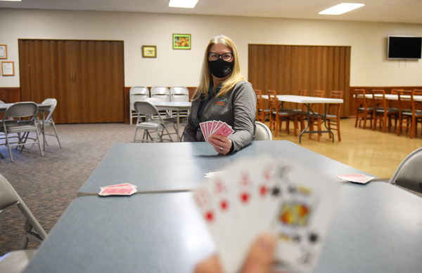
CELINA - For nearly a year now, no bingo cards have been marked, card games played or lunches served inside Mercer County Council on Aging's senior center on Riley Street.
Division IV Girls Basketball District Final
Minster shuts down New Knoxville to win district crown
WAPAKONETA - The first time Minster and New Knoxville met this season, Minster escaped the Barn in New Knoxville with a nine-point win.
The return bout wasn't as close. [More]
Compiled by Gary R. Rasberry
The Celina girls bowling team wrapped up its season on Saturday at the Division I district tournament in Port Clinton.
Division II Boys State Bowling Tournament
Compiled by Gary R. Rasberry
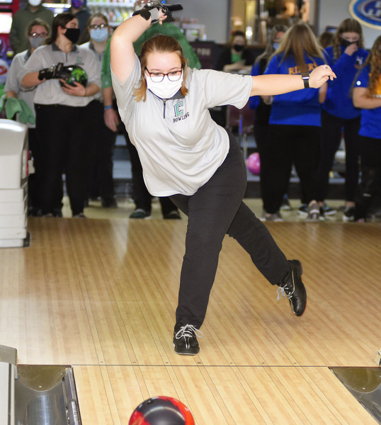
Coldwater's chance to repeat at Division II boys state bowling champion fell just short after losing in the semifinals of the championship round on Saturday at Wayne Webb's Columbus Bowl.
Local pictures on March 1st, 2021