Special Weather Statement issued April 2 at 8:39AM EDT by NWS Wilmington OH (details ...)
At 839 AM EDT, a strong thunderstorm was located near Union City, moving northeast at 60 mph.
HAZARD...Wind gusts up to 40 mph and half inch hail.
SOURCE...Radar indicated.
IMPACT...Gusty winds could knock down tree limbs and blow around unsecured objects. Hail may cause minor damage to vegetation.
Locations impacted include... New Weston, Fryburg, Chickasaw, New Bremen, Fort Recovery, Botkins, New Knoxville, State Route 47 at US Route 127, Eldora Speedway, Neptune, Fort Loramie, Osgood, Moulton, Coldwater, Sharps Crossing, Kossuth, Lake Loramie State Park, North Dayton, Waynesfield, and Minster.
This includes I-75 in Ohio between mile markers 101 and 118.
If outdoors, consider seeking shelter inside a sturdy building.
To report hazardous weather conditions, go to our website at weather.gov/iln and submit your report via social media, when you can do so safely.
Flood Watch issued April 2 at 3:24AM EDT until April 6 at 8:00AM EDT by NWS Wilmington OH (details ...)
* WHAT...Flooding caused by excessive rainfall continues to be possible.
* WHERE...The following counties, in Indiana, Dearborn, Fayette, Franklin, Ohio, Ripley, Switzerland, Union and Wayne, the following counties, in Kentucky, Boone, Bracken, Campbell, Carroll, Gallatin, Grant, Kenton, Lewis, Mason, Owen, Pendleton and Robertson, and the following counties, in Ohio, Adams, Auglaize, Brown, Butler, Champaign, Clark, Clermont, Clinton, Darke, Delaware, Fairfield, Fayette, Franklin, Greene, Hamilton, Hardin, Highland, Hocking, Licking, Logan, Madison, Mercer, Miami, Montgomery, Pickaway, Pike, Preble, Ross, Scioto, Shelby, Union and Warren.
* WHEN...From this evening through Sunday morning.
* IMPACTS...Soils remain moist and excessive runoff may result in flooding of rivers, creeks, streams, and other low-lying and flood-prone locations.
Wind Advisory issued April 2 at 3:21AM EDT until April 3 at 12:00AM EDT by NWS Wilmington OH (details ...)
* WHAT...South winds 15 to 25 mph with gusts up to 50 mph expected.
* WHERE...Portions of east central and southeast Indiana, northern Kentucky, and southwest and west central Ohio.
* WHEN...From 10 AM this morning to midnight EDT tonight.
* IMPACTS...Gusty winds will blow around unsecured objects. Tree limbs could be blown down and a few power outages may result.
Today 74° Today 74° 59° 59° chance Tomorrow 68° Tomorrow 68° chance chance 47° 47°
Thursday, July 6th, 2023
Obituaries on July 6th, 2023
Donald L. Gallehue (Gally), 97, of Celina, passed away on July 5, 2023 at Celina Manor. [More]
Judith Eve Young, 2 days old, died at 11:06 p.m. Monday June 28, 2023 at ProMedica Hospital in Toledo, OH. [More]
Stories on July 6th, 2023
CELINA - City councilors in a few weeks will hold a public hearing over legislation that would amend the city zoning map to allow an auction house to resume operations in the city industrial park.
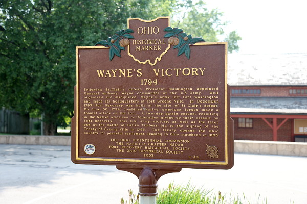
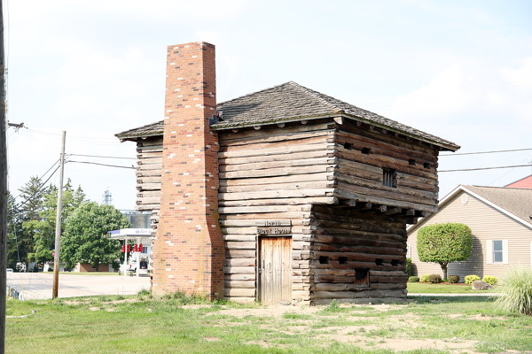
Experts, interpreters featured over 2-day Fort Museum event
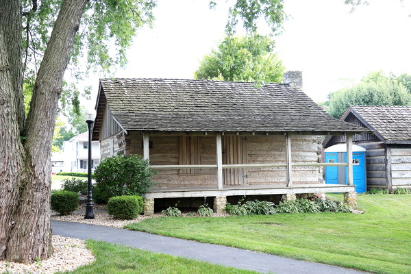
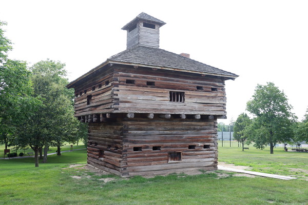
FORT RECOVERY - A special two-day event at Fort Recovery State Museum will highlight the history and culture of Shawnee, Miami and Wyandotte tribes next month. [More]
CELINA - New instructional materials introduced over the last few years to challenge, prepare and empower students to become lifelong learners have yielded positive results in the classroom, curriculum director Vaughn Ray recently informed Celina school board members.
Fort Recovery, Versailles win ACME district openers
FORT RECOVERY - Both sectional winners stumbled on Wednesday, giving Fort Recovery and Versailles the inside track to a district championship.
Fort
Local pictures on July 6th, 2023