Winter Storm Warning issued January 23 at 1:32PM EST until January 26 at 12:00PM EST by NWS Wilmington OH (details ...)
* WHAT...Heavy snow expected. Total snow accumulations between 6 and 9 inches.
* WHERE...Auglaize, Darke, Hardin, Logan, Mercer, and Shelby Counties.
* WHEN...From 10 AM Saturday to noon EST Monday.
* IMPACTS...Travel could be very difficult. The hazardous conditions could impact the Monday morning commute.
Cold Weather Advisory issued January 23 at 1:18PM EST until January 24 at 12:00PM EST by NWS Wilmington OH (details ...)
* WHAT...Very cold wind chills as low as 12 below zero.
* WHERE...In Indiana, Wayne County. In Ohio, Auglaize, Darke, Hardin, Logan, Mercer, and Shelby Counties.
* WHEN...Until noon EST Saturday.
* IMPACTS...The cold wind chills as low as 10 below zero could result in hypothermia if precautions are not taken. Wind chill values can lead to hypothermia with prolonged exposure.
Today Today -1° -1° Tomorrow 10° Tomorrow 10° chance
Monday, November 17th, 2008
It's started already
Photo by Shelley Grieshop/The Daily Standard

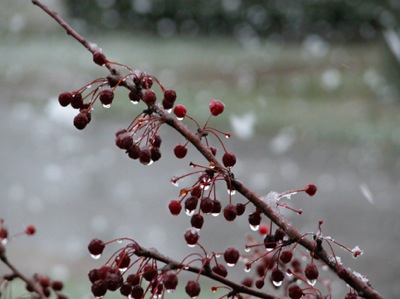
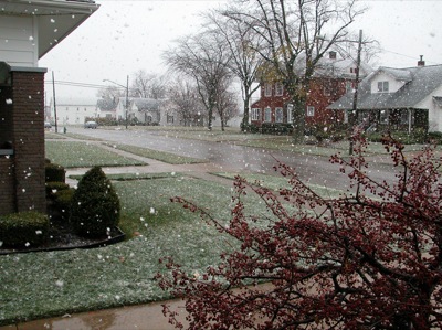
Big flakes of snow fall down in Coldwater on Saturday afternoon as the local area gets its first real glimpse of winter. Local residents woke today to snow-covered lawns and cars as about a quarter-inch of the white stuff fell overnight Sunday. Snow flurries are expected to continue the next 24 hours and highs reach 35 today and 32 on Tuesday, according to local weather forecaster Dennis Howick.

Additional pictures on this date