Severe Thunderstorm Watch issued August 10 at 7:26PM EDT until August 11 at 2:00AM EDT by NWS Wilmington OH (details ...)
THE NATIONAL WEATHER SERVICE HAS ISSUED SEVERE THUNDERSTORM WATCH 560 IN EFFECT UNTIL 2 AM EDT TUESDAY FOR THE FOLLOWING AREAS
IN INDIANA THIS WATCH INCLUDES 1 COUNTY
IN EAST CENTRAL INDIANA
WAYNE
IN OHIO THIS WATCH INCLUDES 21 COUNTIES
IN CENTRAL OHIO
DELAWARE FAIRFIELD FAYETTE FRANKLIN HOCKING LICKING MADISON PICKAWAY UNION
IN WEST CENTRAL OHIO
AUGLAIZE CHAMPAIGN CLARK DARKE GREENE HARDIN LOGAN MERCER MIAMI MONTGOMERY PREBLE SHELBY
THIS INCLUDES THE CITIES OF ADA, BEAVERCREEK, BELLEFONTAINE, CAMDEN, CELINA, CIRCLEVILLE, COLDWATER, DELAWARE, DOWNTOWN COLUMBUS, DOWNTOWN DAYTON, EATON, FAIRBORN, GREENVILLE, KENTON, KETTERING, LANCASTER, LOGAN, LONDON, MARYSVILLE, MINSTER, NEW BREMEN, NEWARK, PICKERINGTON, PIQUA, PLAIN CITY, RICHMOND, SIDNEY, SPRINGFIELD, ST. MARYS, TIPP CITY, TROY, URBANA, WAPAKONETA, WASHINGTON COURT HOUSE, WEST JEFFERSON, AND XENIA.
Flood Watch issued August 10 at 1:04PM EDT until August 12 at 8:00AM EDT by NWS Wilmington OH (details ...)
* WHAT...Flash flooding caused by excessive rainfall is possible.
* WHERE...Portions of Indiana, including the following counties, Dearborn, Fayette, Franklin, Union and Wayne, Kentucky, including the following counties, Boone, Bracken, Campbell, Kenton, Lewis, Mason, Pendleton and Robertson, and Ohio, including the following counties, Adams, Auglaize, Brown, Butler, Champaign, Clark, Clermont, Clinton, Darke, Delaware, Fairfield, Fayette, Franklin, Greene, Hamilton, Hardin, Highland, Hocking, Licking, Logan, Madison, Mercer, Miami, Montgomery, Pickaway, Pike, Preble, Ross, Scioto, Shelby, Union and Warren.
* WHEN...Through Wednesday morning.
* IMPACTS...Excessive runoff may result in flooding of rivers, creeks, streams, and other low-lying and flood-prone locations.
* ADDITIONAL DETAILS... - Several rounds of thunderstorms are expected through Tuesday night. Locally heavy rainfall can be expected with the potential for storms to repeatedly track over the same locations. This will result in the potential for flash flooding.
Today 84° Today 84° chance 68° 68° chance likely Tomorrow 82° Tomorrow 82° likely chance 67° 67° chance
Monday, December 29th, 2008
Obituaries on December 29th, 2008
Former Minster resident Ruth M. Heitkamp, 93, died at 10:30 a.m. Dec. 28, 2008, at Otterbein St. Marys Retirement Community. [More]
Viola Luthman, 103, 11741 Luthman Road, St. Patrick, died at 2:48 p.m. Dec. 27, 2008, at her home. [More]
Mark A. Pohl, 48, 1326 Fort Recovery-Minster Road, Fort Recovery, died at 4:35 [More]
Brother Denis Rumschlag, 91, died Dec. 29, 2008, at Dayton Heart Hospital.
Ar [More]
Darlene "Dolly" Vining, 77, 219 Maple St., St. Marys, died at 3:02 a.m. Dec. 28, 2008, at her residence. [More]
Stories on December 29th, 2008
Wind gusts, 60-plus degree temperatures surprise forecasters
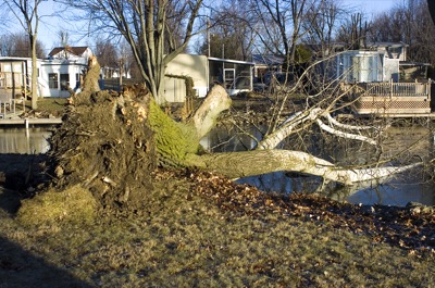
Winds raced through the Grand Lake area Saturday night leaving a few downed trees and limbs in Mercer County. Earlier in the afternoon, high temperature records were broken all over the state.
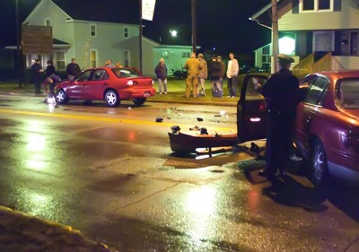
Four teenagers were injured when two cars collided on West Logan Street at Zillah Street. The mishap occurred at 9:41 p.m. Dec. 27, according to Celina Police Department reports. [More]
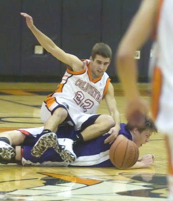
COLDWATER - After last year's three-point nailbiter, fans attending the championship game of the 2008 Mercer Health Holiday Classic were hoping that Coldwater and Fort Recovery would put together an encore in the rematch.
COLDWATER - One had to think with the talent they have and the rich history of the program that the Coldwater girls basketball team would soon snap out of the six-game losing streak the Cavaliers had endured to start the season. [More]
Compiled by Gary R. Rasberry
Fort Recovery jumped out big on undefeated Fort Loramie, then held off a Redskin charge in the third quarter to hold
MARIA STEIN - The Marion Local Flyers used a key third quarter run to pull away from the Covington Buccaneers en route to a 48-34 non-conference win Saturday at the Hangar.

Local pictures on December 29th, 2008