Winter Storm Warning issued January 25 at 9:07PM EST until January 26 at 12:00PM EST by NWS Wilmington OH (details ...)
* WHAT...Areas of blowing snow and continued hazardous travel due to accumulated snowfall. * WHERE...Auglaize, Darke, Hardin, Logan, Mercer, and Shelby Counties. * WHEN...Until noon EST Monday. * IMPACTS...Travel conditions remain very difficult. Plan on slippery road conditions. The hazardous conditions will impact the Monday morning commute.
Cold Weather Advisory issued January 25 at 7:19PM EST until January 26 at 6:00PM EST by NWS Wilmington OH (details ...)
* WHAT...For the Cold Weather Advisory, very cold wind chills as low as 15 below zero expected. For the Extreme Cold Warning, dangerously cold wind chills as low as 25 below zero expected. * WHERE...Portions of east central and southeast Indiana, northeast and northern Kentucky, and central, south central, southwest, and west central Ohio. * WHEN...For the Cold Weather Advisory, from midnight tonight to 6 PM EST Monday. For the Extreme Cold Warning, from 6 PM Monday to noon EST Tuesday. * IMPACTS...The dangerously cold wind chills as low as 25 below zero could cause frostbite on exposed skin in as little as 30 minutes.
Extreme Cold Warning issued January 25 at 7:19PM EST until January 27 at 12:00PM EST by NWS Wilmington OH (details ...)
* WHAT...For the Cold Weather Advisory, very cold wind chills as low as 15 below zero expected. For the Extreme Cold Warning, dangerously cold wind chills as low as 25 below zero expected. * WHERE...Portions of east central and southeast Indiana, northeast and northern Kentucky, and central, south central, southwest, and west central Ohio. * WHEN...For the Cold Weather Advisory, from midnight tonight to 6 PM EST Monday. For the Extreme Cold Warning, from 6 PM Monday to noon EST Tuesday. * IMPACTS...The dangerously cold wind chills as low as 25 below zero could cause frostbite on exposed skin in as little as 30 minutes.
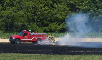
COLDWATER - Several homes and outbuildings were saved Wednesday morning thanks to the efforts of a local farmer and the quick response of area firefighters.
Coldwater-area farmer Rick Dues was baling wheat straw in a 30-acre field along the 3300 block of Siegrist-Jutte Road when he spotted a circle of fire in the stubble. [More]
Former Celina and St. Marys resident Darryl "Red" Montague, 65, of North Massapequa, N.Y., died June 20, 2012, at Mercy Hospital in Rockville Centre, N.Y. [More]
Local agency offering air conditioners, assistance to those in need
Record-breaking heat is expected to bake the area today.
Local weather forecaster Dennis Howick said the record high temperature - 99 degrees on June 28, 1988 - likely will be broken with an expected high of 100 today.
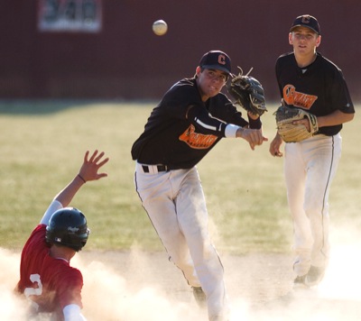
WAPAKONETA - The Wapakoneta ACME baseball team got a four-hit shutout from pitcher Marshall Gerlach and the Redskins rolled to a 5-0 win over Coldwater on Wednesday.
Grand Lake was unable to hold a 1-0 lead as Licking County scored one run in the fifth inning and four more in the eighth for a 5-1 win over the Mariners on Wednesday night at Don Edwards Field in Newark.