Flood Watch issued August 19 at 7:53PM EDT until August 20 at 10:00AM EDT by NWS Wilmington OH (details ...)
* WHAT...Flash flooding caused by excessive rainfall continues to be possible. * WHERE...Portions of east central Indiana, including the following counties, Fayette, Union and Wayne and Ohio, including the following counties, Auglaize, Champaign, Clark, Darke, Delaware, Fairfield, Fayette, Franklin, Greene, Hardin, Hocking, Licking, Logan, Madison, Mercer, Miami, Montgomery, Pickaway, Preble, Shelby and Union. * WHEN...Through Thursday morning. * IMPACTS...Excessive runoff may result in flooding of rivers, creeks, streams, and other low-lying and flood-prone locations. * ADDITIONAL DETAILS... - Repeated rounds of storms, combined with the extremely wet soil conditions will increase the risk for flash flooding into the overnight hours.
Flood Advisory issued August 19 at 6:30PM EDT until August 19 at 9:00PM EDT by NWS Wilmington OH (details ...)
* WHAT...Flooding caused by excessive rainfall continues. * WHERE...Southern Mercer County in west central Ohio... * WHEN...Until 900 PM EDT. * IMPACTS...Minor flooding in low-lying and poor drainage areas. * ADDITIONAL DETAILS... - At 630 PM EDT, radar indicated heavy rain due to thunderstorms. Minor flooding is ongoing or expected to begin shortly in the advisory area. Between 1 and 2 inches of rain have fallen. Additional rainfall amounts of 0.5 to 1 inch are possible. - Some locations that may experience flooding include... Coldwater, St. Henry, Fort Recovery, Chickasaw, Burkettsville, Montezuma, Carthagena and Maria Stein.
Flood Advisory issued August 19 at 6:33PM EDT until August 19 at 10:30PM EDT by NWS Wilmington OH (details ...)
* WHAT...Flooding caused by excessive rainfall continues. * WHERE...Southern Auglaize County in west central Ohio... Northwestern Logan County in west central Ohio... Northern Shelby County in west central Ohio... * WHEN...Until 1030 PM EDT. * IMPACTS...Minor flooding in low-lying and poor drainage areas. Water over roadways. * ADDITIONAL DETAILS... - At 633 PM EDT, radar and automated rain gauges indicated heavy rain due to thunderstorms. Minor flooding is ongoing or expected to begin shortly in the advisory area. Between 1 and 2 inches of rain have fallen. Additional rainfall amounts of 0.5 to 1 inch are possible. - Some locations that may experience flooding include... New Bremen, Minster, Jackson Center, Russells Point, Botkins, Lakeview, Huntsville, Kettlersville, Montra, Mccartyville, Lewistown and Egypt.
CELINA - Mercer County Council on Aging board members are eyeing a possible expansion of the senior center on Riley Street to alleviate cramped conditions due to an influx of people using a growing number of services. [More]
BUTLER TOWNSHIP - A 4-year-old boy struck by a pickup truck on Thursday on State Route 219 was listed in fair condition on Friday afternoon at Dayton Children's Hospital, according to hospital spokeswoman Stacy Porter.
CELINA - Mercer County commissioners this week signed off on a resolution declaring the necessity of replacing a water line in the Harbor Point subdivision in East Jefferson Township.
DAYTON - Wright State University's faculty union members on Thursday filed an unfair labor practice claim with the State Employment Relations Board against the university.
ST. HENRY - St. Henry boys basketball coach Eric Rosenbeck had plenty of reasons to smile after Friday's 61-31 win over New Bremen in MAC action at Redskin Gymnasium.
Celina snapped a six-game losing streak and earned a historical victory in defeating Bath 63-36 in Western Buckeye League boys basketball action on Friday night at the Tub in Bath Township.
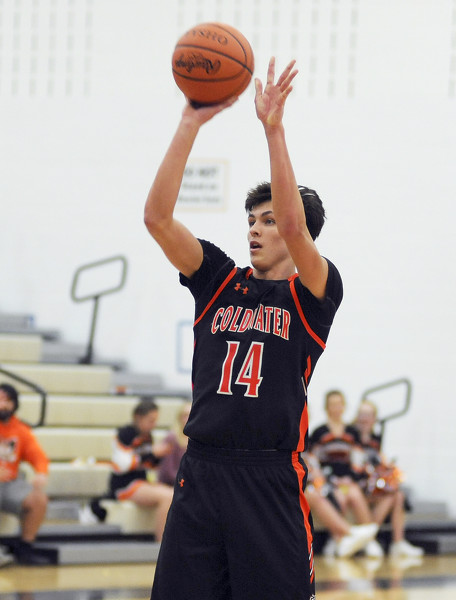
Coldwater struggles shooting in 51-42 loss to Minster
MINSTER - As his team walked onto the floor to start the fourth quarter, Coldwater coach Nick Fisher said to an assistant "Our shooting woes have continued."
It didn't get any better for the Cavaliers in the final quarter, either. [More]