Heat Advisory issued July 4 at 12:25AM EDT until July 4 at 8:00PM EDT by NWS Wilmington OH (details ...)
* WHAT...Heat index values up to 100 expected. * WHERE...Portions of east central and southeast Indiana, northeast and northern Kentucky, and central, south central, southwest, and west central Ohio. * WHEN...Until 8 PM EDT this evening. * IMPACTS...Hot temperatures and high humidity may cause heat illnesses. * ADDITIONAL DETAILS...Remember, multiple days with excessive heat can have compounding effects.
Friday, February 21st, 2020
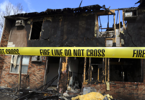
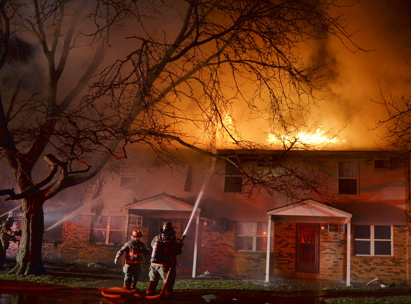
Photo by Dan Melograna/The Daily Standard
Damage from Wednesday night's fire that started in apartment 47 and spread to the remaining four units is apparent Thursday morning.
COLDWATER - A blaze that consumed an apartment complex late Wednesday night, possibly injuring two residents, causing $500,000 worth of damage and leaving about 10 people homeless, has reportedly been ruled an accident by the state fire marshal. [More]