Severe Thunderstorm Watch issued August 11 at 2:39PM EDT until August 11 at 8:00PM EDT by NWS Wilmington OH (details ...)
SEVERE THUNDERSTORM WATCH 567 REMAINS VALID UNTIL 8 PM EDT THIS EVENING FOR THE FOLLOWING AREAS
IN INDIANA THIS WATCH INCLUDES 4 COUNTIES
IN EAST CENTRAL INDIANA
FAYETTE UNION WAYNE
IN SOUTHEAST INDIANA
FRANKLIN
IN OHIO THIS WATCH INCLUDES 23 COUNTIES
IN CENTRAL OHIO
DELAWARE FAIRFIELD FAYETTE FRANKLIN LICKING MADISON PICKAWAY UNION
IN SOUTHWEST OHIO
BUTLER CLINTON WARREN
IN WEST CENTRAL OHIO
AUGLAIZE CHAMPAIGN CLARK DARKE GREENE HARDIN LOGAN MERCER MIAMI MONTGOMERY PREBLE SHELBY
THIS INCLUDES THE CITIES OF ADA, BEAVERCREEK, BELLEFONTAINE, BLANCHESTER, BROOKVILLE, CAMDEN, CELINA, CIRCLEVILLE, COLDWATER, CONNERSVILLE, DELAWARE, DOWNTOWN COLUMBUS, DOWNTOWN DAYTON, EATON, FAIRBORN, FAIRFIELD, FRANKLIN, GREENVILLE, HAMILTON, KENTON, KETTERING, LANCASTER, LANDEN, LEBANON, LIBERTY, LONDON, MARYSVILLE, MASON, MIDDLETOWN, MINSTER, NEW BREMEN, NEWARK, OXFORD, PICKERINGTON, PIQUA, PLAIN CITY, RICHMOND, SIDNEY, SPRINGBORO, SPRINGFIELD, ST. MARYS, TIPP CITY, TROY, URBANA, WAPAKONETA, WASHINGTON COURT HOUSE, WEST COLLEGE CORNER, WEST JEFFERSON, WILMINGTON, AND XENIA.
Flood Watch issued August 11 at 12:05PM EDT until August 12 at 8:00AM EDT by NWS Wilmington OH (details ...)
* WHAT...Flash flooding caused by excessive rainfall continues to be possible.
* WHERE...Portions of Indiana, including the following counties, Dearborn, Fayette, Franklin, Ohio, Ripley, Switzerland, Union and Wayne, Kentucky, including the following counties, Boone, Bracken, Campbell, Carroll, Gallatin, Grant, Kenton, Lewis, Mason, Owen, Pendleton and Robertson, and Ohio, including the following counties, Adams, Auglaize, Brown, Butler, Champaign, Clark, Clermont, Clinton, Darke, Delaware, Fairfield, Fayette, Franklin, Greene, Hamilton, Hardin, Highland, Hocking, Licking, Logan, Madison, Mercer, Miami, Montgomery, Pickaway, Pike, Preble, Ross, Scioto, Shelby, Union and Warren.
* WHEN...Through Wednesday morning.
* IMPACTS...Excessive runoff may result in flooding of rivers, creeks, streams, and other low-lying and flood-prone locations.
* ADDITIONAL DETAILS... - Several rounds of thunderstorms are expected into Wednesday morning. Locally heavy rainfall can be expected with the potential for storms to repeatedly track over the same locations. This will result in the potential for flash flooding.
Today 83° Today 83° chance 66° 66° chance Tomorrow 83° Tomorrow 83° slight chance slight chance 66° 66° chance likely
Saturday, January 14th, 2023
Obituaries on January 14th, 2023
Donald L. Ralston, 90, formerly of Rockford, passed away peacefully in the earl [More]
Stories on January 14th, 2023
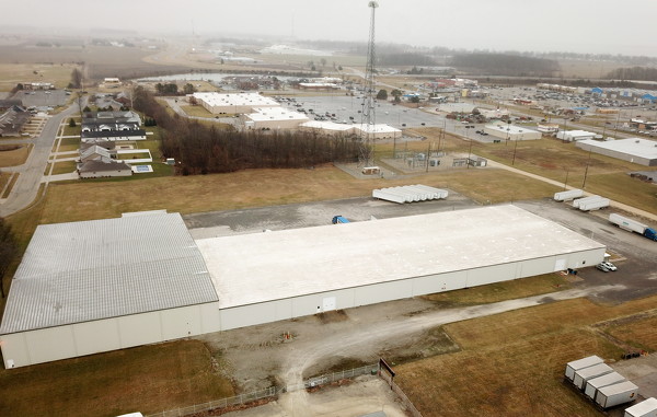
Logistics company buys warehouse for $2.7 million
CELINA - A Bellefontaine-based logistics company has purchased the warehouse and warehousing operations of L&L Distribution, Inc., in a $2.7 million acquisition.

WAPAKONETA - Auglaize County commissioners this week signed off on county sheriff Mike Vorhees' request to purchase a $316,723 armored vehicle for special response operations such as hostage situations.
CELINA - If anything, the past two Friday home basketball games for Celina has been helpful in raising the heart rates of the fans.  
A week after h
ST. MARYS - St. Marys and Van Wert traded blows for 32 minutes, and when the final horn sounded, the Roughriders survived with a 62-60 victory Friday night at Grand Lake Health Systems Court.

Hess, Flyers hold off Cardinals in fourth
MARIA STEIN - Marion Local coach Kurt Goettemoeller took one for the team Friday night.
His team got him the win.
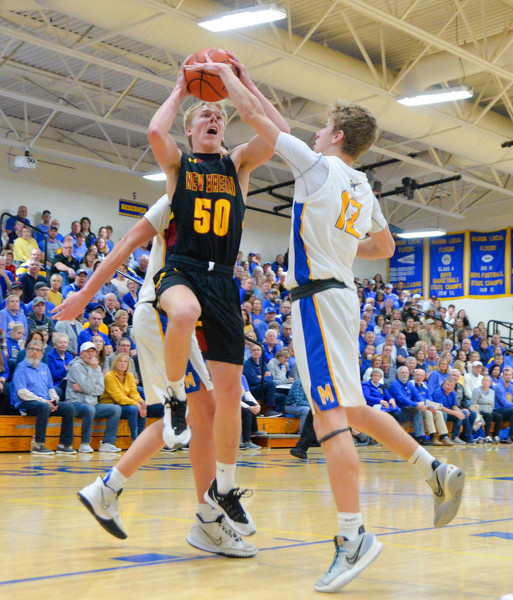
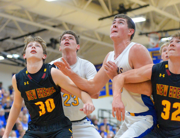
Marion battled past New Brem [More]
COLDWATER - Coldwater finally got some separation on a hot streak behind the arc at the end of the first half, then brought its defense to bear to hold off Fort Recovery down the stretch.
Compiled By Tom Haines
St. Henry pulled away in the third quarter to overcome New Knoxville 72-54 in a Midwest Athletic Conference boys basketball win at the Barn Friday night.

Local pictures on January 14th, 2023