Special Weather Statement issued May 1 at 8:06PM EDT by NWS Wilmington OH (details ...)
At 806 PM EDT, a strong thunderstorm was located over Monroe, moving northeast at 35 mph. HAZARD...Wind gusts up to 45 mph and pea size hail. SOURCE...Radar indicated. IMPACT...Gusty winds could knock down tree limbs and blow around unsecured objects. Hail may cause minor damage to vegetation. This storm will remain over mainly rural areas of northwestern Mercer County. If outdoors, consider seeking shelter inside a sturdy building. To report hazardous weather conditions, go to our website at weather.gov/iln and submit your report via social media, when you can do so safely.
Wednesday, July 19th, 2006
Extending the pier
Photo by Jennalee Ziegler/The Daily Standard
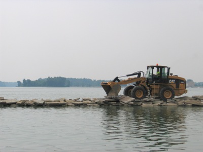
Celina Public Works Department employee Joe Hartings uses the city's new front-end loader to dump some concrete along a pier off Lake Shore Drive on Tuesday.