The Daily Standard
Pictures Archive

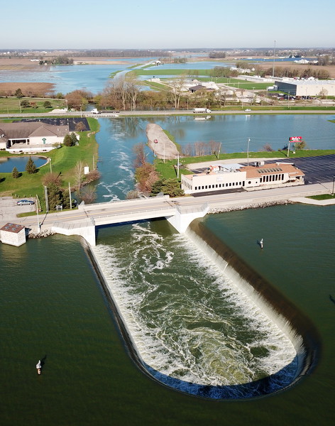
Last week's rain has filled Grand Lake and the excess water is draining over the west bank spillway into Beaver Creek. The creek is overflowing its banks, causing flooding. According to the U.S. Geological Survey stream gauge at U.S. 127 the peak flow was 940 cubic feet per second Sunday night at 10:45 p.m. That flow would fill an Olympic-sized pool in about a minute and a half. The average for April 16-Thursday was 162 cubic feet per second. The highest flow registered since the gauge came online in October 2013 is 1,770 cubic feet per second on June 18, 2015. A photo album with more pictures is online at dailystandard.com.