Flood Watch issued April 5 at 4:53AM EDT until April 6 at 8:00AM EDT by NWS Wilmington OH (details ...)
* WHAT...Flooding caused by excessive rainfall continues to be possible.
* WHERE...The following counties, in Indiana, Dearborn, Fayette, Franklin, Ohio, Ripley, Switzerland, Union and Wayne, the following counties, in Kentucky, Boone, Bracken, Campbell, Carroll, Gallatin, Grant, Kenton, Lewis, Mason, Owen, Pendleton and Robertson, and the following counties, in Ohio, Adams, Auglaize, Brown, Butler, Champaign, Clark, Clermont, Clinton, Darke, Delaware, Fairfield, Fayette, Franklin, Greene, Hamilton, Hardin, Highland, Hocking, Licking, Logan, Madison, Mercer, Miami, Montgomery, Pickaway, Pike, Preble, Ross, Scioto, Shelby, Union and Warren.
* WHEN...Through Sunday morning.
* IMPACTS...Excessive runoff may result in flooding of rivers, creeks, streams, and other low-lying and flood-prone locations.
* ADDITIONAL DETAILS... - Moderate to heavy rainfall will continue into Sunday, with the heaviest rainfall expected Saturday afternoon into Saturday night.
48° 48° Sat 62° Sat 62° 37° 37° Sun 44° Sun 44° chance
Friday, August 9th, 2019
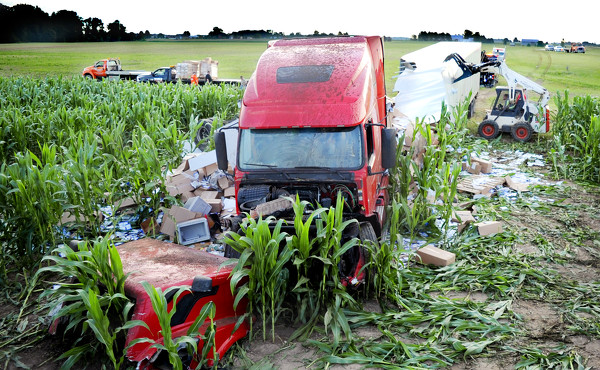
Photo by Dan Melograna/The Daily Standard

A semitrailer transporting packing material for feminine products crashed into a cornfield along State Route 29 on Thursday morning in Celina.

Related online story:
CELINA - The driver of a semitrailer transporting packing material for feminine products was hospitalized after his vehicle went into a cornfield along State Route 29 early Thursday morning. [More]
Additional picture on this date