Severe Thunderstorm Warning issued April 19 at 6:42AM EDT until April 19 at 7:00AM EDT by NWS Wilmington OH (details ...)
At 642 AM EDT, a severe thunderstorm was located near Celina, moving northeast at 70 mph.
HAZARD...60 mph wind gusts and penny size hail.
SOURCE...Radar indicated.
IMPACT...Expect damage to trees and power lines.
Locations impacted include... New Weston, Wabash, Tama, Chickasaw, New Bremen, Fort Recovery, Rose Hill, Maria Stein, New Knoxville, Neptune, Moulton, Coldwater, St. Marys, Chattanooga, Kossuth, Celina, North Dayton, Mendon, Burkettsville, and Montezuma.
Severe Thunderstorm Warning issued April 19 at 6:31AM EDT until April 19 at 7:00AM EDT by NWS Wilmington OH (details ...)
SVRILN
The National Weather Service in Wilmington has issued a
* Severe Thunderstorm Warning for... Shelby County in west central Ohio... Darke County in west central Ohio... Southwestern Auglaize County in west central Ohio... Southeastern Mercer County in west central Ohio... Miami County in west central Ohio...
* Until 700 AM EDT.
* At 631 AM EDT, a severe thunderstorm was located over Union City, moving northeast at 75 mph.
HAZARD...60 mph wind gusts and penny size hail.
SOURCE...Radar indicated.
IMPACT...Expect damage to trees and power lines.
* Locations impacted include... New Weston, Casstown, Union Corners, Newbern, Bradford, Potsdam, Lockington, New Bremen, Darke County Airport, Covington, State Route 47 at US Route 127, Eldora Speedway, Fort Loramie, Osgood, Hardin, Piqua, Bloomer, Greenville, Lake Loramie State Park, and Arcanum.
This includes I-75 in Ohio between mile markers 72 and 96.
Today 66° Today 66° likely 48° 48° chance Tomorrow 64° Tomorrow 64° slight chance 58° 58° chance
Saturday, May 29th, 2021
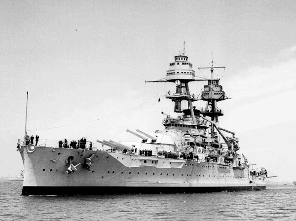
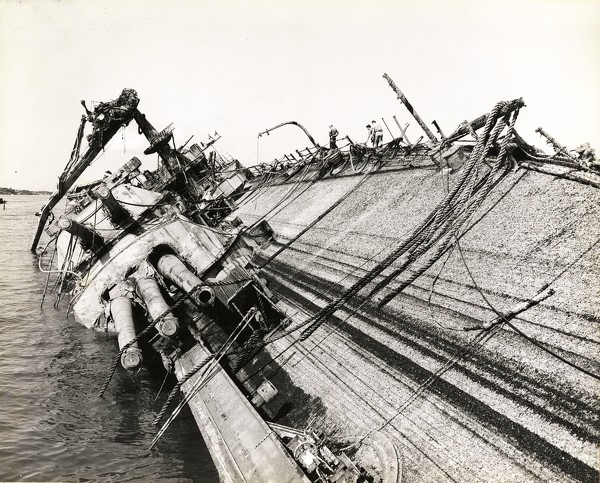
Submitted Photo

The USS Oklahoma in 1938.

Related online story:
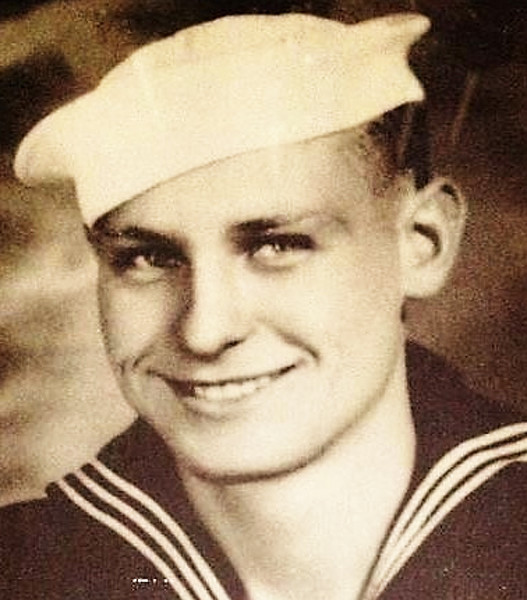
CELINA - Robert Edward Bailey, 21, was waiting for his brother to join him on the USS Oklahoma in Hawaii during the early hours of a day that now lives in infamy. [More]
Additional pictures on this date