The Daily Standard
Pictures Archive
Menu
▼
Home
Subscribe
E-Edition
Archives
▼
Archives
Obituary Archives
Photo Albums
Podcasts
▼
Podcasts
Video
Classifieds
▼
Classifieds
Public Notices
Weather
Sports
More
▼
Contacts
Advertising
Subscription Payment
Community Pictures
Historical Maps
Forms
Locations
Elections
32°
32°
Mon
47°
Mon
47°
29°
29°
Tue
53°
Tue
53°
Monday, November 1st, 2021
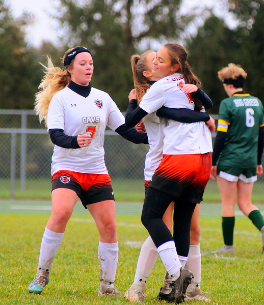
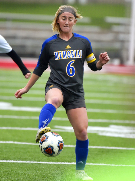
Photo by Gary R. Rasberry/The Daily Standard
Coldwater players celebrate the first goal of the day against Ottoville.
Related online story:
On to regional
OTTOVILLE - After losing to Ottoville 2-1 in the regular season finale, Coldwater was looking to settle the score in the Division III district girls soccer semifinal on the Big Green's home turf on Saturday afternoon. [
More
]
Purchase a print of this photo.
Archive of November 1st, 2021
Buy this E-Edition
Additional pictures on this date
<!--Unsupported browser-->
Copyright © 2026 Standard Printing Co. All Rights Reserved