FORT RECOVERY - The Monday fire that fully engulfed and destroyed the large barn at Wenning Farm is estimated to have caused about $1 million in damage. [
More]
Turn lane planned for Fremont Co.
CELINA - Mercer County commissioners on Tuesday awarded VTF Excavation of Celina a $322,696 contract for roadway work related to the $27 million expansion of Fremont Co. in Rockford.
ST. MARYS - A representative from Origin Malts spoke to members of the public at Monday's Ag Solutions meeting about the benefits of growing barley.
ROCKFORD - Parkway High School alumnus Joel Henkle was hired on Tuesday night as the new head varsity football coach for the upcoming season.
Funds will help pay for keycard system, security cameras
MARIA STEIN - School board members at their meeting Monday night accepted a school safety grant and approved the purchase of keycard systems and security cameras.
Auglaize County
WAPAKONETA - Auglaize County Health Board members discussed at Tuesday's meeting a growing public health concern over bedbugs in the area.
Environm
CELINA- Mercer County Board of Elections members invite residents on Thursday to try out and offer their thoughts on an array of voting systems under consideration for purchase.
St. Marys
ST. MARYS - Residents of Windsor Drive are under a boil advisory after the replacement of a water valve in this area.
The St. Marys Water Departmen
Coldwater
COLDWATER - School board members on Monday accepted multiple donations totaling more than $3,000.
Donations included a Ber-Vac snowblower valued at
Mercer County maintained the lowest unemployment rate in the state for the month of January.
The county's rate dropped to 3.2 percent from 3.5 percent in December, according to data released on Tuesday from the Ohio Department of Job and Family Services.

St. Henry advances to play Jackson Center on Friday
KETTERING - Halfway through the third quarter Tuesday night, St. Henry locked in defensively.
That allowed the Redskins to lock up a victory.
Compiled by Gary R. Rasberry
Fort Recovery girls basketball coach Brian Patch stepped down on Tuesday morning after five seasons as coach.
A press release from Fort Recovery interim athletic director Barb Sautbine stated that his departure is due to family reasons.
Divisions III-IV All-Ohio Girls Basketball
Minster sophomore Ivy Wolf was named first team All-Ohio in Division IV as the Ohio Prep Sports Writers Association released its honors list for Divisions III and IV on Tuesday.

CELINA - Area residents will be able to go to the gym whenever they choose at the new Anytime Fitness.
The 24/7 gym is open for business to help residents with their fitness goals, operations director Matt Cline said.
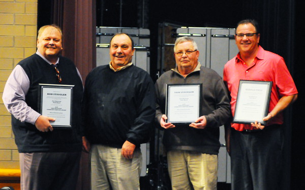
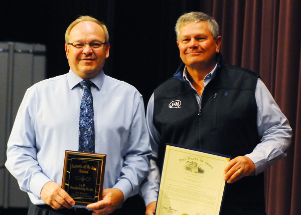
FORT RECOVERY - Several community members were honored on Sunday during the Fort Recovery Chamber of Commerce's annual awards banquet
Citizen of th
CELINA - Celina and the greater Mercer County area placed among the nation's top 100 micropolitans for the fourth consecutive year.
Celina tied with 21 other communities at No. 41 on the Top 100 Micropolitans on Site Selections magazine's Governors Cup listings.