Severe Thunderstorm Warning issued August 10 at 9:49PM EDT until August 10 at 10:30PM EDT by NWS Wilmington OH (details ...)
SVRILN
The National Weather Service in Wilmington has issued a
* Severe Thunderstorm Warning for... Northeastern Shelby County in west central Ohio... Southern Auglaize County in west central Ohio... Central Mercer County in west central Ohio...
* Until 1030 PM EDT.
* At 948 PM EDT, a severe thunderstorm was located near St. Marys, moving southeast at 45 mph.
HAZARD...60 mph wind gusts and quarter size hail.
SOURCE...Radar indicated.
IMPACT...Minor hail damage to vehicles is possible. Expect wind damage to trees and power lines.
* Locations impacted include... Celina, Wapakoneta, St. Marys, Coldwater, New Bremen, Minster, Anna, Jackson Center, Botkins, New Knoxville, Moulton, Wabash, Port Jefferson, Kettlersville, Montezuma, Fryburg, Montra, Tama, Neptune, and Maplewood.
This includes I-75 in Ohio between mile markers 96 and 112.
Severe Thunderstorm Warning issued August 10 at 9:29PM EDT until August 10 at 10:15PM EDT by NWS Wilmington OH (details ...)
SVRILN
The National Weather Service in Wilmington has issued a
* Severe Thunderstorm Warning for... Northwestern Auglaize County in west central Ohio... Northern Mercer County in west central Ohio...
* Until 1015 PM EDT.
* At 929 PM EDT, a severe thunderstorm was located near Ohio City, moving east at 35 mph.
HAZARD...60 mph wind gusts and quarter size hail.
SOURCE...Radar indicated.
IMPACT...Minor hail damage to vehicles is possible. Expect wind damage to trees and power lines.
* Locations impacted include... Wapakoneta, Fort Shawnee, Cridersville, Rockford, Mendon, Buckland, Uniopolis, Chattanooga, Kossuth, Tama, St. Johns, Neptune, and State Route 116 at State Route 197.
This includes I-75 in Ohio between mile markers 111 and 118.
Severe Thunderstorm Watch issued August 10 at 7:26PM EDT until August 11 at 2:00AM EDT by NWS Wilmington OH (details ...)
THE NATIONAL WEATHER SERVICE HAS ISSUED SEVERE THUNDERSTORM WATCH 560 IN EFFECT UNTIL 2 AM EDT TUESDAY FOR THE FOLLOWING AREAS
IN INDIANA THIS WATCH INCLUDES 1 COUNTY
IN EAST CENTRAL INDIANA
WAYNE
IN OHIO THIS WATCH INCLUDES 21 COUNTIES
IN CENTRAL OHIO
DELAWARE FAIRFIELD FAYETTE FRANKLIN HOCKING LICKING MADISON PICKAWAY UNION
IN WEST CENTRAL OHIO
AUGLAIZE CHAMPAIGN CLARK DARKE GREENE HARDIN LOGAN MERCER MIAMI MONTGOMERY PREBLE SHELBY
THIS INCLUDES THE CITIES OF ADA, BEAVERCREEK, BELLEFONTAINE, CAMDEN, CELINA, CIRCLEVILLE, COLDWATER, DELAWARE, DOWNTOWN COLUMBUS, DOWNTOWN DAYTON, EATON, FAIRBORN, GREENVILLE, KENTON, KETTERING, LANCASTER, LOGAN, LONDON, MARYSVILLE, MINSTER, NEW BREMEN, NEWARK, PICKERINGTON, PIQUA, PLAIN CITY, RICHMOND, SIDNEY, SPRINGFIELD, ST. MARYS, TIPP CITY, TROY, URBANA, WAPAKONETA, WASHINGTON COURT HOUSE, WEST JEFFERSON, AND XENIA.
Flood Watch issued August 10 at 1:04PM EDT until August 12 at 8:00AM EDT by NWS Wilmington OH (details ...)
* WHAT...Flash flooding caused by excessive rainfall is possible.
* WHERE...Portions of Indiana, including the following counties, Dearborn, Fayette, Franklin, Union and Wayne, Kentucky, including the following counties, Boone, Bracken, Campbell, Kenton, Lewis, Mason, Pendleton and Robertson, and Ohio, including the following counties, Adams, Auglaize, Brown, Butler, Champaign, Clark, Clermont, Clinton, Darke, Delaware, Fairfield, Fayette, Franklin, Greene, Hamilton, Hardin, Highland, Hocking, Licking, Logan, Madison, Mercer, Miami, Montgomery, Pickaway, Pike, Preble, Ross, Scioto, Shelby, Union and Warren.
* WHEN...Through Wednesday morning.
* IMPACTS...Excessive runoff may result in flooding of rivers, creeks, streams, and other low-lying and flood-prone locations.
* ADDITIONAL DETAILS... - Several rounds of thunderstorms are expected through Tuesday night. Locally heavy rainfall can be expected with the potential for storms to repeatedly track over the same locations. This will result in the potential for flash flooding.
69° 69° chance Tue 82° Tue 82° likely 66° 66° likely Wed 82° Wed 82° chance
Wednesday, July 29th, 2020
Officials hope wetlands stanch blue-green algae
By Sydney Albert
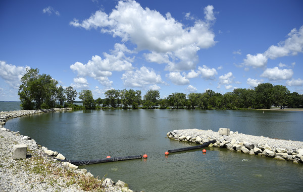
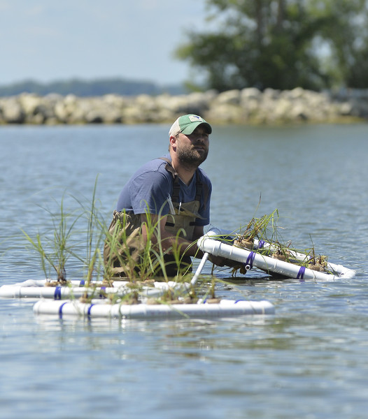
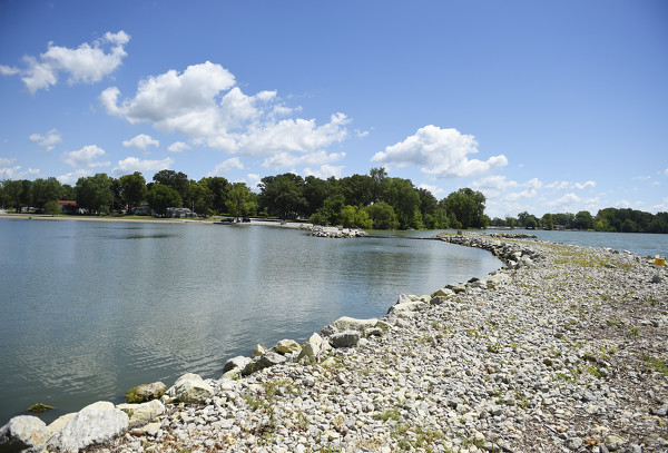
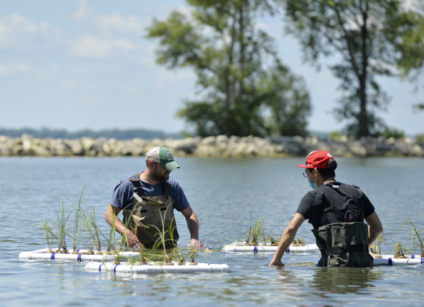
ST. MARYS - A group of scientists has begun testing another technique to clean up the water in the experimental Grand Lake St. Marys State Park West Beach area.
Officials from the Wright State University-Lake Campus, the Lake Restoration Commission and Ohio State University placed four floating wetlands in the water to see if they can remove the nutrients that feed the harmful algae. Professor Stephen Jacquemin and a graduate student placed the floating wetlands in the beach area on Tuesday. [More]
Obituaries on July 29th, 2020
Lucy Victoria Beckstedt, age 84, of Celina, Ohio passed away on Monday, July 27, 2020 at the Briarwood Village Nursing Home, in Coldwater. [More]
Local pictures on July 29th, 2020
Subscriber stories on July 29th, 2020
CELINA - In a refreshing change of pace, no new cases of COVID-19 were reported in Mercer County on Tuesday, maintaining the county's number of cases at 452.

By AMY KRONENBERGER
and WILLIAM KINCAID
newsdept@dailystandard.com
Local fair officials are scrambling for answers after Gov. Mike DeWine on
CELINA - Mercer County commissioners on Tuesday awarded nearly $1.5 million in contracts for two major roadway projects.
Commissioners accepted the
MENDON - Village council members met briefly on Tuesday evening and approved a motion to seek bids for a used bucket truck.
Street commissioner Ran