Special Weather Statement issued April 2 at 8:39AM EDT by NWS Wilmington OH (details ...)
At 839 AM EDT, a strong thunderstorm was located near Union City, moving northeast at 60 mph.
HAZARD...Wind gusts up to 40 mph and half inch hail.
SOURCE...Radar indicated.
IMPACT...Gusty winds could knock down tree limbs and blow around unsecured objects. Hail may cause minor damage to vegetation.
Locations impacted include... New Weston, Fryburg, Chickasaw, New Bremen, Fort Recovery, Botkins, New Knoxville, State Route 47 at US Route 127, Eldora Speedway, Neptune, Fort Loramie, Osgood, Moulton, Coldwater, Sharps Crossing, Kossuth, Lake Loramie State Park, North Dayton, Waynesfield, and Minster.
This includes I-75 in Ohio between mile markers 101 and 118.
If outdoors, consider seeking shelter inside a sturdy building.
To report hazardous weather conditions, go to our website at weather.gov/iln and submit your report via social media, when you can do so safely.
Flood Watch issued April 2 at 3:24AM EDT until April 6 at 8:00AM EDT by NWS Wilmington OH (details ...)
* WHAT...Flooding caused by excessive rainfall continues to be possible.
* WHERE...The following counties, in Indiana, Dearborn, Fayette, Franklin, Ohio, Ripley, Switzerland, Union and Wayne, the following counties, in Kentucky, Boone, Bracken, Campbell, Carroll, Gallatin, Grant, Kenton, Lewis, Mason, Owen, Pendleton and Robertson, and the following counties, in Ohio, Adams, Auglaize, Brown, Butler, Champaign, Clark, Clermont, Clinton, Darke, Delaware, Fairfield, Fayette, Franklin, Greene, Hamilton, Hardin, Highland, Hocking, Licking, Logan, Madison, Mercer, Miami, Montgomery, Pickaway, Pike, Preble, Ross, Scioto, Shelby, Union and Warren.
* WHEN...From this evening through Sunday morning.
* IMPACTS...Soils remain moist and excessive runoff may result in flooding of rivers, creeks, streams, and other low-lying and flood-prone locations.
Wind Advisory issued April 2 at 3:21AM EDT until April 3 at 12:00AM EDT by NWS Wilmington OH (details ...)
* WHAT...South winds 15 to 25 mph with gusts up to 50 mph expected.
* WHERE...Portions of east central and southeast Indiana, northern Kentucky, and southwest and west central Ohio.
* WHEN...From 10 AM this morning to midnight EDT tonight.
* IMPACTS...Gusty winds will blow around unsecured objects. Tree limbs could be blown down and a few power outages may result.
Today 74° Today 74° 59° 59° chance Tomorrow 68° Tomorrow 68° chance chance 47° 47°
Friday, April 1st, 2022
Obituaries on April 1st, 2022
Paula Kay McIlroy, 79, of Celina, Ohio, went home to the Lord on Tuesday, March 29, 2022. [More]
Shirley R. Luthman, age 73 of Celina, died, Friday, March 25, 2022 at Divine Nursing at Shane Hill in Rockford. [More]
Stories on April 1st, 2022
Bald eagles continue to flourish in the area with at least 14 eagle nests confirmed in Mercer and Auglaize counties.
Jill Bowers, who has monit [More]
ST. MARYS-A hundred years ago, Jim Tully, a St. Marys native and author, published the autobiographical novel "Emmett Lawler." At least two movies were based on his novels.
Celina shuts out Parkway on four-hitter
CELINA - The cold weather couldn't stymie Celina's pitching on Thursday night.
Dylan Feister pitched six innings of four-hit shutout baseball and f
CELINA - After almost three hours in swirling winds and low temperatures, the Parkway softball team got the first scoreless inning of the night just in time to close out Celina.
MARIA STEIN - Marion Local swimmer Riley Bruns signed a national letter of intent to continue his career at NCAA Division III Bluffton University on Thursday.
Area Roundup
Compiled by Gary R. Rasberry
Keegan Bruggeman pitched a three-hitter as Coldwater improved to 2-0 on the baseball season with a 3-1 win over Shawnee in Allen County on Thursday.
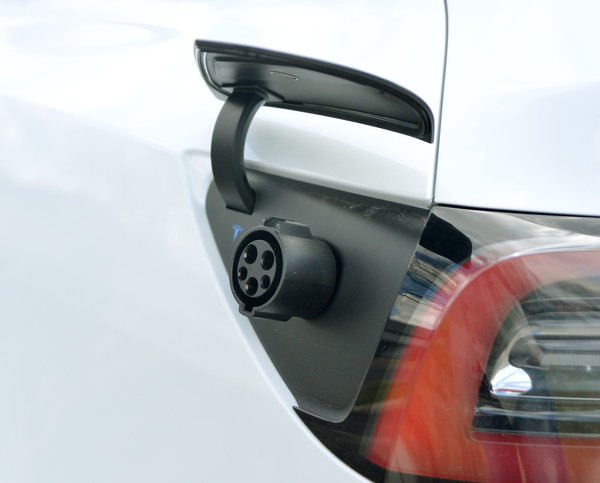
The doubling of electric car sales and of its relatives, the hybrid and plug-in hybrid cars, has local officials and drivers of such vehicles charged up.
Local pictures on April 1st, 2022