Severe Thunderstorm Warning issued July 3 at 7:07PM EDT until July 3 at 7:45PM EDT by NWS Wilmington OH (details ...)
At 707 PM EDT, a severe thunderstorm was located over St. Marys, moving east at 30 mph.
HAZARD...60 mph wind gusts.
SOURCE...Radar indicated.
IMPACT...Expect damage to trees and power lines.
Locations impacted include... Celina, Wapakoneta, St. Marys, Rockford, New Knoxville, Moulton, Mendon, Buckland, Montezuma, Kossuth, Tama, Neptune, and Bulkhead.
Extreme Heat Warning issued July 3 at 11:21AM EDT until July 3 at 8:00PM EDT by NWS Wilmington OH (details ...)
* WHAT...For the Extreme Heat Warning, dangerously hot conditions with heat index values around 105 are expected. For the Heat Advisory, heat index values around 100 are expected.
* WHERE...Portions of east central and southeast Indiana, northeast and northern Kentucky, and central, south central, southwest, and west central Ohio.
* WHEN...For the Extreme Heat Warning, until 8 PM EDT this evening. For the Heat Advisory, from 8 PM this evening to 8 PM EDT Saturday.
* IMPACTS...Heat related illnesses increase significantly during extreme heat and high humidity events, particularly for those working or participating in outdoor activities. Hot temperatures and high humidity may cause heat illnesses.
* ADDITIONAL DETAILS...Remember, multiple days with excessive heat can have compounding effects.
Heat Advisory issued July 3 at 11:21AM EDT until July 4 at 8:00PM EDT by NWS Wilmington OH (details ...)
* WHAT...For the Extreme Heat Warning, dangerously hot conditions with heat index values around 105 are expected. For the Heat Advisory, heat index values around 100 are expected.
* WHERE...Portions of east central and southeast Indiana, northeast and northern Kentucky, and central, south central, southwest, and west central Ohio.
* WHEN...For the Extreme Heat Warning, until 8 PM EDT this evening. For the Heat Advisory, from 8 PM this evening to 8 PM EDT Saturday.
* IMPACTS...Heat related illnesses increase significantly during extreme heat and high humidity events, particularly for those working or participating in outdoor activities. Hot temperatures and high humidity may cause heat illnesses.
* ADDITIONAL DETAILS...Remember, multiple days with excessive heat can have compounding effects.
Today 93° Today 93° slight chance 75° 75° chance Tomorrow 90° Tomorrow 90° slight chance 72° 72° chance likely

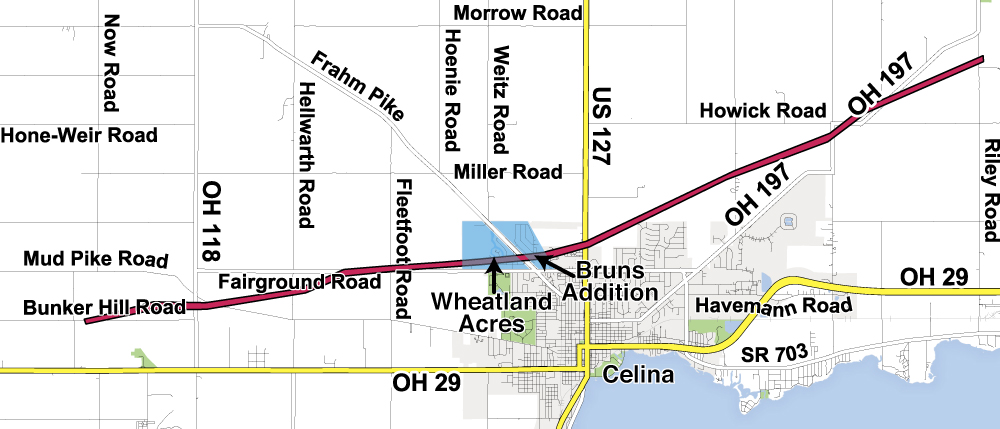
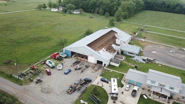
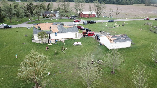
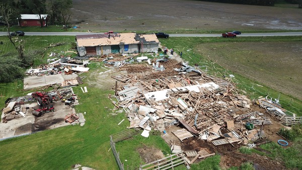
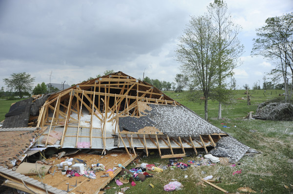
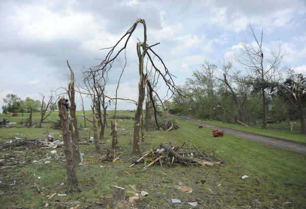
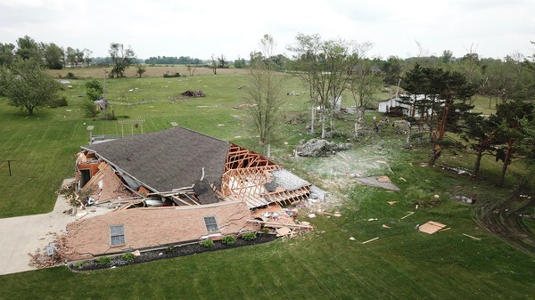
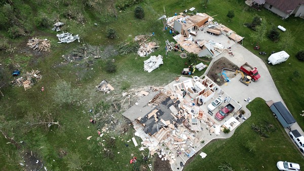
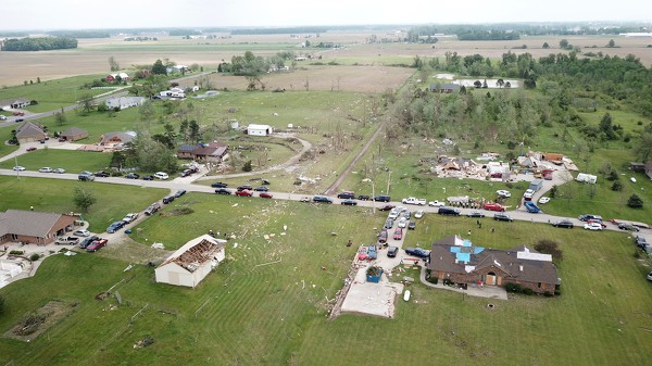
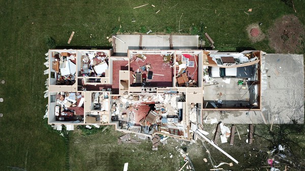
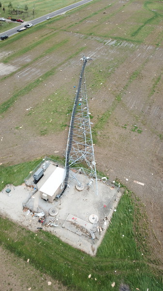
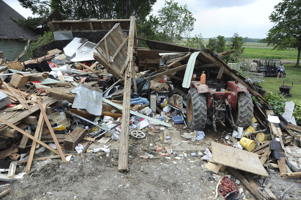
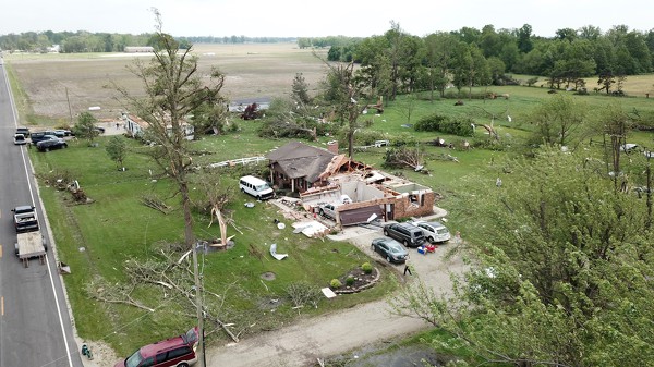
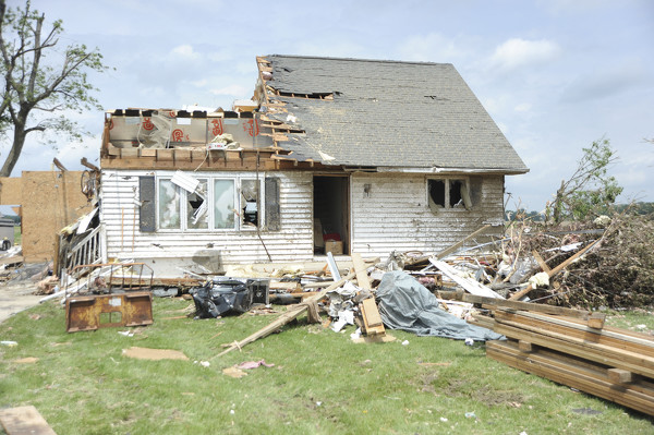
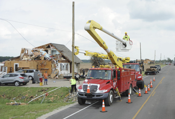
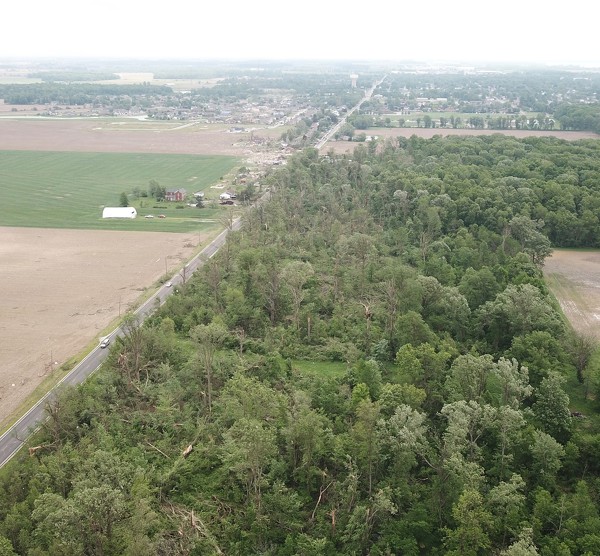
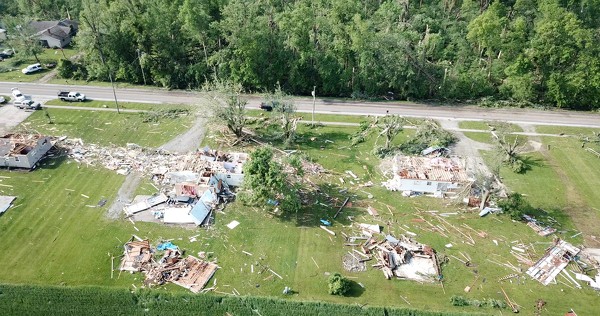
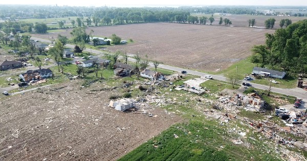
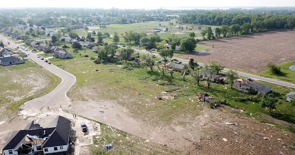
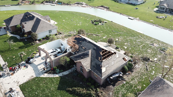
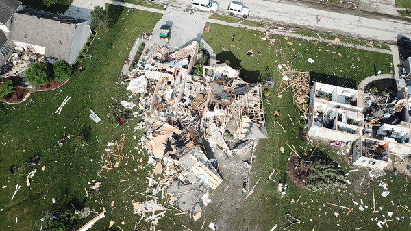
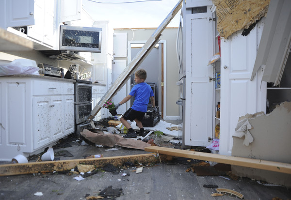
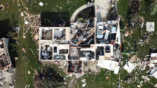
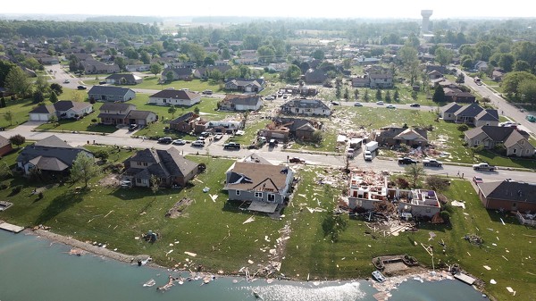
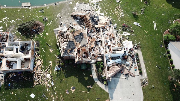
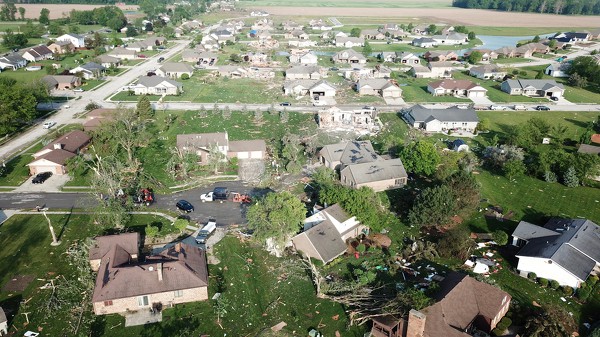
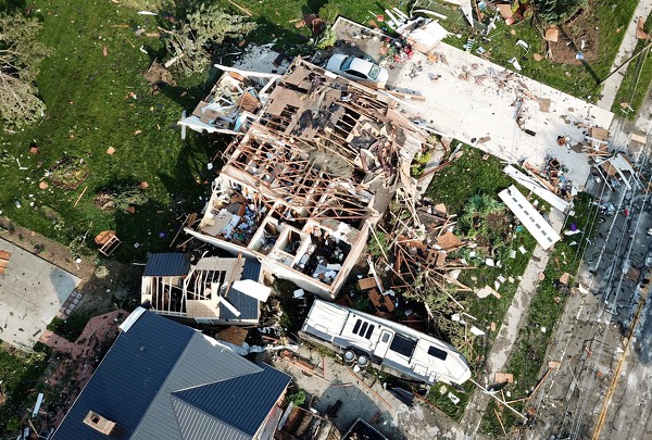
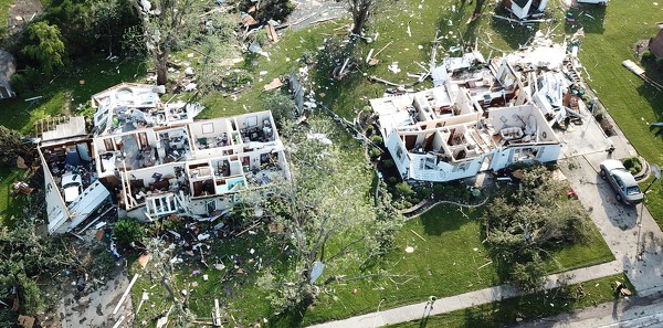
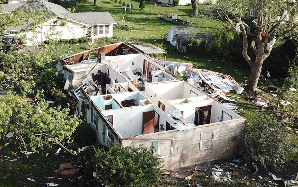
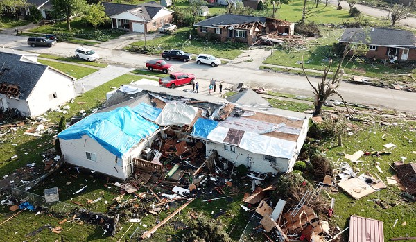
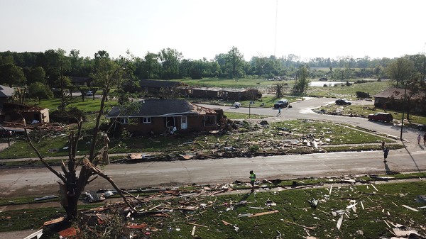
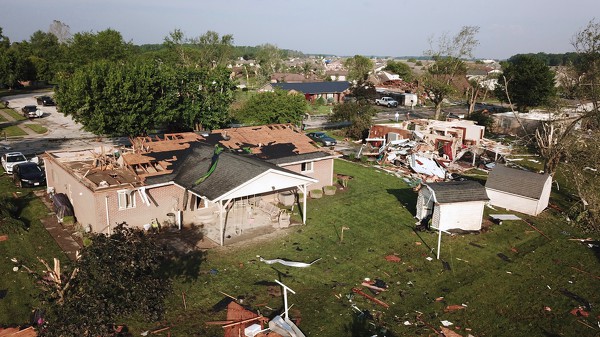
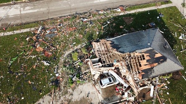
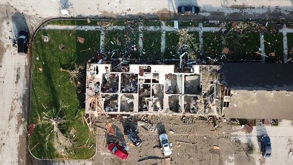
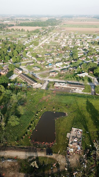
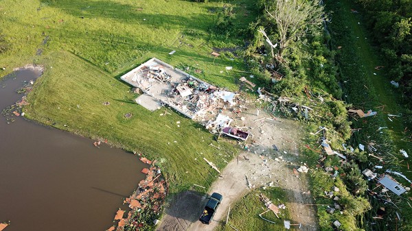
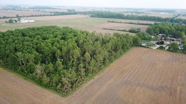
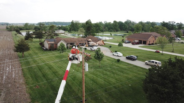
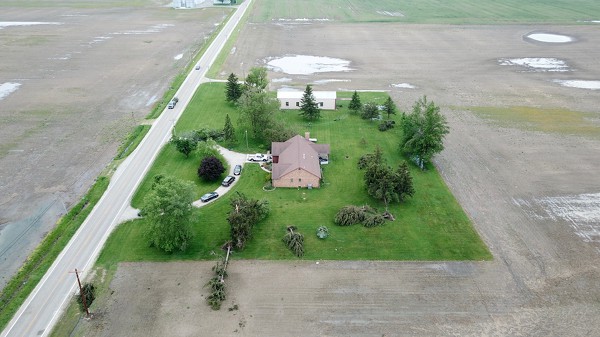
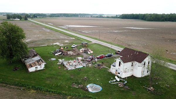
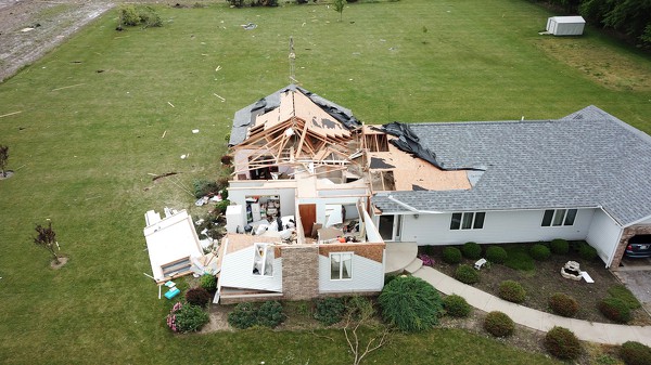
An EF3 tornado spun through central Mercer County during the late evening Memorial Day 2019. Along the path, the tornado tore off the roofs of houses, flipped vehicles and shredded trees. One fatality occurred and at least seven people were seriously injured. The tornado started west of Celina around Bunker Hill Rd and traveled east-northeast into Celina where it impacted the Bruns Addition and Wheatland Acres neighborhoods. The tornado continued to the east where it dissipated near Riley road south of Neptune.

Tornado coverage:
Officials asked to re-evaluate response
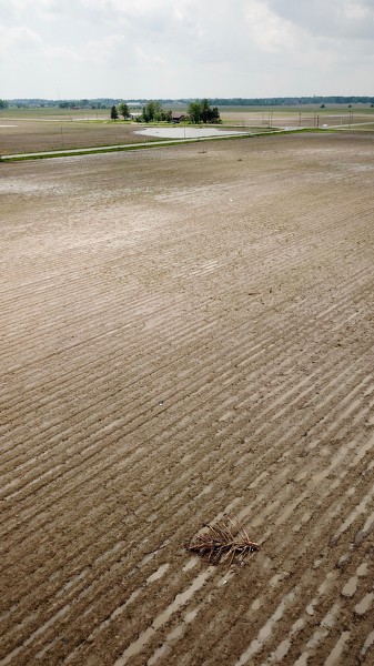
Volunteers clean up farm fields
Batting cleanup: Mariners help pick up debris in wake of tornado
Photo album: One Week Later
Laundromat on wheels rolls into city
Tornado displaces residents
Photo album: Cleanup continues Thursday
Teachers, staffers pitch in to aid cleanup
Restaurants, churches, club keeping volunteers well fed
Photo album: Tornado cleanup Wednesday
Celina cleanup starts, seven serious injuries one fatality reported
Governor declares a state of emergency
EF3 tornado wind speed reached 150 mph
Story from Tuesday's edition.​
Photo album that focuses on Bruns Addition and Wheatland Acres in Celina.
Photo album that focuses on the rural areas outside town.
Video of Ohio Governor Mike DeWine addressing the press.
Photo album from Monday night.
National Weather Service report.
Not all tornado coverage is online; additional stories are in our print and e-editions.

1
2
3
4
5
6
7
8
9
10
11
12
13
1
2
3
4
5
6
7
8
9
10
11
12
13