Severe Thunderstorm Warning issued August 11 at 8:23AM EDT until August 11 at 9:00AM EDT by NWS Wilmington OH (details ...)
At 823 AM EDT, a severe thunderstorm was located near St. Henry, moving southeast at 40 mph.
HAZARD...60 mph wind gusts.
SOURCE...Radar indicated.
IMPACT...Expect damage to trees and power lines.
Locations impacted include... Coldwater, Versailles, St. Henry, Bradford, Webster, Gettysburg, Osgood, Chickasaw, Burkettsville, North Star, Montezuma, New Weston, Yorkshire, Darke County Airport, Maria Stein, Brock, State Route 47 at US Route 127, Eldora Speedway, Carthagena, and Willowdell.
Severe Thunderstorm Warning issued August 11 at 8:18AM EDT until August 11 at 9:00AM EDT by NWS Wilmington OH (details ...)
At 817 AM EDT, severe thunderstorms were located along a line extending from near Union City to 7 miles southeast of Muncie, moving southeast at 40 mph.
HAZARD...60 mph wind gusts.
SOURCE...Radar indicated.
IMPACT...Expect damage to trees and power lines.
Locations impacted include... Richmond, Greenville, Centerville, Arcanum, Hagerstown, Union City, Fort Recovery, Ansonia, New Madison, Fountain City, Dublin, Franklin, Wayne Lakes, Gettysburg, Greens Fork, Pitsburg, Bethel, Hollansburg, Rossburg, and Palestine.
This includes I-70 in Indiana between mile markers 134 and 148.
Flood Watch issued August 11 at 4:12AM EDT until August 12 at 8:00AM EDT by NWS Wilmington OH (details ...)
* WHAT...Flash flooding caused by excessive rainfall continues to be possible.
* WHERE...Portions of Indiana, including the following counties, Dearborn, Fayette, Franklin, Union and Wayne, Kentucky, including the following counties, Boone, Bracken, Campbell, Kenton, Lewis, Mason, Pendleton and Robertson, and Ohio, including the following counties, Adams, Auglaize, Brown, Butler, Champaign, Clark, Clermont, Clinton, Darke, Delaware, Fairfield, Fayette, Franklin, Greene, Hamilton, Hardin, Highland, Hocking, Licking, Logan, Madison, Mercer, Miami, Montgomery, Pickaway, Pike, Preble, Ross, Scioto, Shelby, Union and Warren.
* WHEN...Through Wednesday morning.
* IMPACTS...Excessive runoff may result in flooding of rivers, creeks, streams, and other low-lying and flood-prone locations.
* ADDITIONAL DETAILS... - Several rounds of thunderstorms are expected into Wednesday morning. Locally heavy rainfall can be expected with the potential for storms to repeatedly track over the same locations. This will result in the potential for flash flooding.
Severe Thunderstorm Warning issued August 11 at 8:34AM EDT until August 11 at 9:15AM EDT by NWS Wilmington OH (details ...)
At 834 AM EDT, a severe thunderstorm was located over Fort Loramie, moving east at 45 mph.
HAZARD...60 mph wind gusts.
SOURCE...Radar indicated.
IMPACT...Expect damage to trees and power lines.
Locations impacted include... Troy, Sidney, Piqua, New Bremen, Minster, Covington, Newport, Bradford, Anna, Fort Loramie, Jackson Center, Pleasant Hill, Botkins, New Knoxville, Hardin, Russia, Laura, Fletcher, Port Jefferson, and Casstown.
This includes I-75 in Ohio between mile markers 71 and 106.
Special Weather Statement issued August 11 at 8:34AM EDT by NWS Wilmington OH (details ...)
At 834 AM EDT, a rapidly developing thunderstorm was located near Chippewa Park, moving east at 45 mph.
HAZARD...Wind gusts up to 50 mph and half inch hail.
SOURCE...Radar indicated.
IMPACT...Gusty winds could knock down tree limbs and blow around unsecured objects. Hail may cause minor damage to vegetation.
Locations impacted include... Bellefontaine, Kenton, Richwood, Russells Point, Lakeview, Alger, Belle Center, West Mansfield, Chippewa Park, Northwood, Blanchard, Roundhead, Mount Victory, Rushsylvania, Mcguffey, Huntsville, Ridgeway, Zanesfield, Raymond, and New Jerusalem.
If outdoors, consider seeking shelter inside a sturdy building.
To report hazardous weather conditions, go to our website at weather.gov/iln and submit your report via social media, when you can do so safely.
Today 83° Today 83° chance 66° 66° chance Tomorrow 83° Tomorrow 83° slight chance slight chance 66° 66° chance likely
Friday, November 2nd, 2012
Obituaries on November 2nd, 2012
Jerry Lee Roberts, 62, Union City, Ind., died Oct. 31, 2012, at Hospice of Dayton. [More]
John Martin Rutherford, 71, of Eubank, Ky., and formerly of St. Henry, died Oct. 29, 2012, at Select Specialty Hospital, Lexington, Ky. [More]
Stories on November 2nd, 2012
Consultant says earlier comment on alum's failure was misinterpreted
GRAND LAKE - A consultant compiling a report on the effectiveness of this year's alum treatment on Grand Lake refuted a widely circulated story that said alum treatments on the lake aren't working. [More]
CELINA - Mercer County Commissioners were delighted with the low bids received to repair the storm-damaged grandstand roof at the fairgrounds.
Seven sealed bids ranging from $293,000 to $398,600 were opened by commissioners Thursday. The project was estimated at $376,464.
Newspaper prints final edition after 128 years
COLDWATER - In a farewell column in the Oct. 18, 2012, final edition of The Mercer County Chronicle, contributor Georgia Rindler wrote that the newsp
Burkettsville
BURKETTSVILLE - State and county officials have penned an agreement to help fund a nearly $1.2 million enhancement project in the village.
Mercer C
Charges include armed robbery of service station
ST. MARYS - A St. Marys man on Thursday pleaded not guilty to numerous charges including the armed robbery of a gas station on Oct. 9.
Glenn Tuttle
Nursing facilities, long-time community volunteer recognized
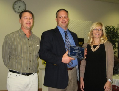
ROCKFORD - A local citizen and business were honored for their service to the community during the 39th annual Rockford Chamber of Commerce banquet Thursday. [More]
CELINA - When and how manure is applied are two important factors that can help reduce nutrient runoff that contributes to toxic algae blooms in waterways.
Attorneys for a former anesthesiologist convicted in the death of his wife, Celina native Kathy Wangler, are seeking another hearing in the Third District Court of Appeals.
Division III Regional Volleyball at Findlay
FINDLAY - Thursday's Division III volleyball regional semifinal at Findlay High School was a roller coaster of emotions for Coldwater and Cavaliers' head coach Mike Etzler.
Last Curtain Call
Although she will be hundreds of miles away and several decades removed from her days of running at Coldwater High School, former Cavaliers' standout Diane (Baucher) Gerlach understands all too well what a few girls from her alma mater are experiencing this weekend.
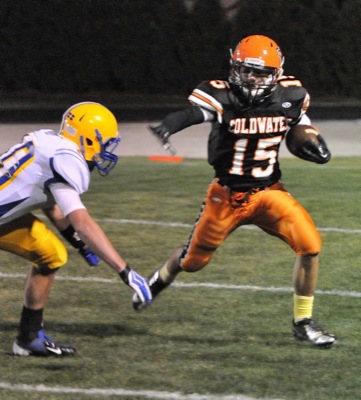
Coldwater's quest to reach the state championship game for the fourth straight year begins on Saturday night when the Cavaliers host Miami East in the Division V postseason opener.

Local pictures on November 2nd, 2012