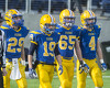
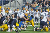
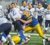
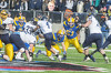
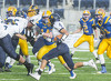
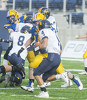
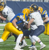
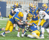
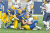
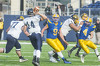
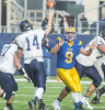
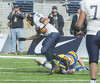
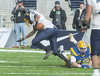
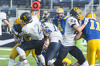
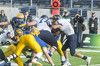
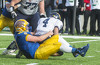
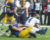
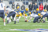
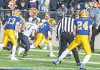
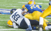
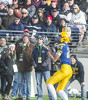
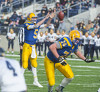
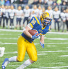
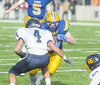
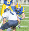
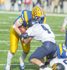
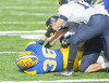
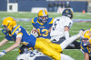
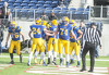
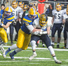
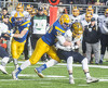
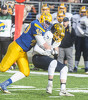
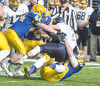
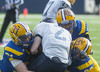
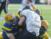
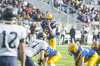
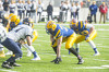
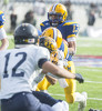
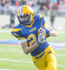
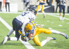
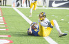
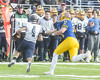
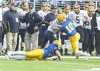
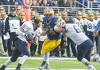
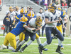
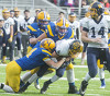
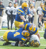
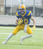
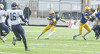
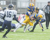
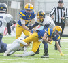
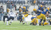
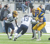
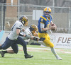
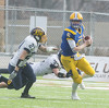
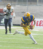
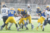
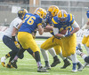
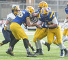
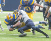
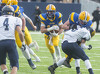
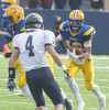
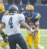
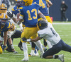
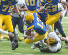
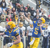
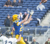
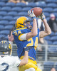
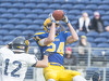
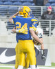
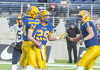
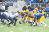
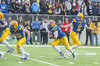
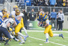
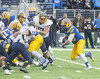
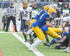
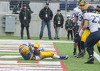
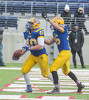
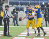
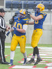
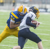
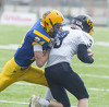
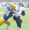
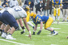
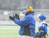
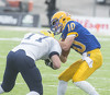
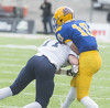
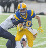
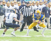
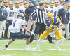
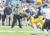
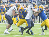
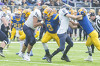
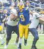
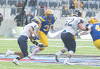
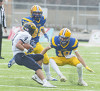
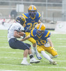
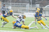
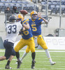
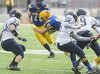
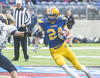
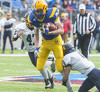
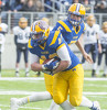
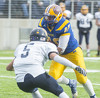
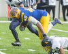
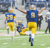
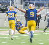
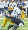
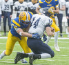
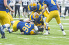
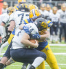
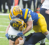
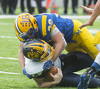
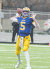
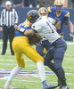
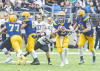
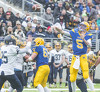
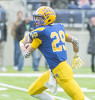
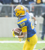
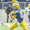
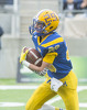
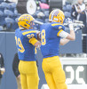
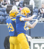
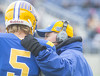
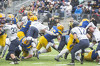
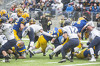
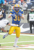
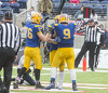
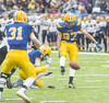
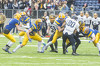
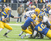
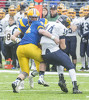
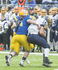
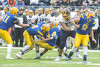
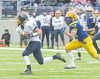
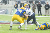
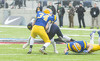
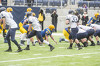
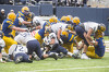
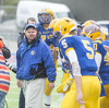
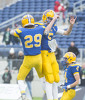
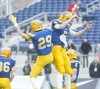
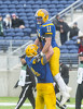
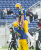
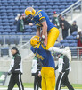
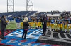
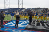
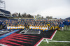
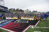
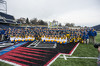
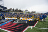
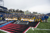
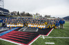
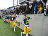
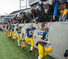
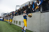
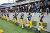
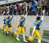
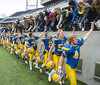
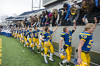
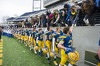
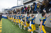
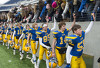
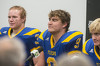
Marion Local vs Kirtland football
6 of 343 pictures
Saturday, December 2nd, 2017
Photo by Mark Pummell/The Daily Standard
Severe Thunderstorm Warning issued April 01 at 12:12AM EDT until April 01 at 1:15AM EDT by NWS Wilmington (details ...)
The National Weather Service in Wilmington has issued a * Severe Thunderstorm Warning for... Shelby County in west central Ohio... Darke County in west central Ohio... Auglaize County in west central Ohio... Mercer County in west central Ohio... Northern Miami County in west central Ohio... * Until 115 AM EDT. * At 1212 AM EDT, severe thunderstorms were located along a line extending from Monroe to Redkey, moving northeast at 70 mph. HAZARD...70 mph wind gusts and penny size hail. SOURCE...Radar indicated. IMPACT...Expect considerable tree damage. Damage is likely to mobile homes, roofs, and outbuildings. * Locations impacted include... Sidney, Piqua, Greenville, Celina, Wapakoneta, St. Marys, Coldwater, Fort Shawnee, New Bremen, Minster, Versailles, Covington, St. Henry, Newport, Cridersville, Bradford, Union City, Anna, Fort Loramie and Jackson Center. This includes I-75 in Ohio between mile markers 82 and 118. THUNDERSTORM DAMAGE THREAT...CONSIDERABLE HAIL THREAT...RADAR INDICATED MAX HAIL SIZE...0.75 IN WIND THREAT...RADAR INDICATED MAX WIND GUST...70 MPH
Tornado Watch issued March 31 at 11:05PM EDT until April 01 at 5:00AM EDT by NWS Storm Prediction Center (details ...)
TORNADO WATCH 100 IS IN EFFECT UNTIL 500 AM EDT FOR THE FOLLOWING LOCATIONS OH . OHIO COUNTIES INCLUDED ARE ALLEN AUGLAIZE BUTLER CHAMPAIGN CLARK CLERMONT CLINTON DARKE GREENE HAMILTON HARDIN LOGAN MERCER MIAMI MONTGOMERY PAULDING PREBLE PUTNAM SHELBY VAN WERT WARREN
Wind Advisory issued March 31 at 3:11PM EDT until April 01 at 6:00PM EDT by NWS Wilmington (details ...)
...WIND ADVISORY REMAINS IN EFFECT FROM 8 AM TO 6 PM EDT SATURDAY... * WHAT...West winds 20 to 30 mph with gusts up to 50 mph expected. * WHERE...Portions of East Central and Southeast Indiana, Northern Kentucky and Central, South Central, Southwest and West Central Ohio. * WHEN...From 8 AM to 6 PM EDT Saturday. * IMPACTS...Gusty winds could blow around unsecured objects. Tree limbs could be blown down and a few power outages may result.
Today 58° Today 58° 49° 49° chance Tomorrow 51° Tomorrow 51° chance 28° 28° slight chance
thum pict
thum pict
thum pict
thum pict
thum pict
thum pict
thum pict
thum pict
thum pict
thum pict
thum pict
thum pict
thum pict
thum pict
thum pict
thum pict
thum pict
thum pict
thum pict
thum pict
thum pict
thum pict
thum pict
thum pict
thum pict
thum pict
thum pict
thum pict
thum pict
thum pict
thum pict
thum pict
thum pict
thum pict
thum pict
thum pict
thum pict
thum pict
thum pict
thum pict
thum pict
thum pict
thum pict
thum pict
thum pict
thum pict
thum pict
thum pict
thum pict
thum pict
thum pict
thum pict
thum pict
thum pict
thum pict
thum pict
thum pict
thum pict
thum pict
thum pict
thum pict
thum pict
thum pict
thum pict
thum pict
thum pict
thum pict
thum pict
thum pict
thum pict
thum pict
thum pict
thum pict
thum pict
thum pict
thum pict
thum pict
thum pict
thum pict
thum pict
thum pict
thum pict
thum pict
thum pict
thum pict
thum pict
thum pict
thum pict
thum pict
thum pict
thum pict
thum pict
thum pict
thum pict
thum pict
thum pict
thum pict
thum pict
thum pict
thum pict
thum pict
thum pict
thum pict
thum pict
thum pict
thum pict
thum pict
thum pict
thum pict
thum pict
thum pict
thum pict
thum pict
thum pict
thum pict
thum pict
thum pict
thum pict
thum pict
thum pict
thum pict
thum pict
thum pict
thum pict
thum pict
thum pict
thum pict
thum pict
thum pict
thum pict
thum pict
thum pict
thum pict
thum pict
thum pict
thum pict
thum pict
thum pict
thum pict
thum pict
thum pict
thum pict
thum pict
thum pict
thum pict
thum pict
thum pict
thum pict
thum pict
thum pict
thum pict
thum pict
thum pict
thum pict
thum pict
thum pict
thum pict
thum pict
thum pict
thum pict
thum pict
thum pict
thum pict
thum pict
thum pict
thum pict
thum pict
thum pict
thum pict
thum pict
thum pict
thum pict
thum pict
thum pict
thum pict
thum pict
thum pict
thum pict
thum pict
thum pict
thum pict
thum pict
thum pict
thum pict
thum pict
thum pict
thum pict
thum pict
thum pict
thum pict
thum pict
thum pict
thum pict
thum pict
thum pict
thum pict
thum pict
thum pict
thum pict
thum pict
thum pict
thum pict
thum pict
thum pict
thum pict
thum pict
thum pict
thum pict
thum pict
thum pict
thum pict
thum pict
thum pict
thum pict
thum pict
thum pict
thum pict
thum pict
thum pict
thum pict
thum pict
thum pict
thum pict
thum pict
thum pict
thum pict
thum pict
thum pict
thum pict
thum pict
thum pict
thum pict
thum pict
thum pict
thum pict
thum pict
thum pict
thum pict
thum pict
thum pict
thum pict
thum pict
thum pict
thum pict
thum pict
thum pict
thum pict
thum pict
thum pict
thum pict
thum pict
thum pict
thum pict
thum pict
thum pict
thum pict
thum pict
thum pict
thum pict
thum pict
thum pict
thum pict
thum pict
thum pict
thum pict
thum pict
thum pict
thum pict
thum pict
thum pict
thum pict
thum pict
thum pict
thum pict
thum pict
thum pict
thum pict
thum pict
thum pict
thum pict
thum pict
thum pict
thum pict
thum pict
thum pict
thum pict
thum pict
thum pict
thum pict
thum pict
thum pict
thum pict
thum pict
thum pict
thum pict
thum pict
thum pict
thum pict
thum pict
thum pict
thum pict
thum pict
thum pict
thum pict
thum pict
thum pict
thum pict
thum pict
thum pict
thum pict
thum pict
thum pict
thum pict
thum pict
thum pict
thum pict
thum pict
thum pict
thum pict
thum pict
thum pict
thum pict
thum pict
thum pict
thum pict
thum pict
thum pict
thum pict
thum pict
thum pict
thum pict
thum pict
thum pict
thum pict
thum pict
thum pict
thum pict
thum pict
thum pict
thum pict
thum pict
thum pict
thum pict